 Long Hikes
Pennsylvania
Forest Hiking Trails in Pennsylvania
Trails with forest among their main terrain. 13 of the 19 trails in Pennsylvania, 13 with a GPX here. All the trails in Pennsylvania.
The longest is North Country Trail, 4,600 miles (7,403 km). The shortest is Loyalsock Trail, 59 miles (95 km). 2 loops.
The quickest to walk whole is Loyalsock Trail, about 4 to 5 days, and the slowest is North Country Trail, about 8 to 12 months. Terrain is on file for 13 of them; the most common is forest (13), farmland (3), alpine (1) and lakes (1). By designation: National Scenic Trails (2) and Clubs and associations (10). The highest point stated is 6,624 ft2,019 m, on Appalachian Trail.
13 trails
- Official trail with a GPX here
- Route with a GPX here
- No GPX here: its page says where to get one
-

National Scenic Trail
Appalachian National Scenic Trail AT
The Appalachian Trail follows the Appalachian Mountains from Springer Mountain in Georgia to Katahdin in Maine.
- Length
- 2,198 mi3,537 km
- Time
- 5 to 7 months
- GPX
- GPX hereGPX and GeoJSON
- Climb
- 466,594 ft142,218 mcomputed
-
Baker Trail
The Baker Trail is a hiking and backpacking trail north of Pittsburgh that runs through western Pennsylvania to Forest County.
PA United States
- Length
- 134 mi216 km
- Time
- About 8 to 11 days estimate
- GPX
- GPX hereGPX and GeoJSON
- Climb
- 15,302 ft4,664 mcomputed
-
Conestoga Trail
The Conestoga Trail runs north and south through Lancaster County, Pennsylvania, in woods, along streams and on roads.
PA United States
- Length
- 64 mi103 km
- Time
- About 4 to 6 days estimate
- GPX
- GPX hereGPX and GeoJSON
- Climb
- 6,155 ft1,876 mcomputed
-

Highlands Trail
The Highlands Trail runs across the New Jersey and New York Highlands, connecting the Delaware and Hudson rivers, with continuations into Pennsylvania and Connecticut.
- Length
- 180 mi290 km
- Time
- About 1 to 2 weeks estimate
- GPX
- GPX hereGPX and GeoJSON
- Climb
- 24,783 ft7,554 mcomputed
-
Laurel Highlands Hiking Trail LHHT
The Laurel Highlands Hiking Trail stretches along Laurel Mountain from the Youghiogheny River at Ohiopyle State Park to the Conemaugh Gorge near Johnstown.
PA United States
- Length
- 70 mi113 km
- Time
- 8 days
- GPX
- GPX hereGPX and GeoJSON
- Climb
- 12,320 ft3,755 mcomputed
-

Loyalsock Trail LT
The Loyalsock Trail is an end-to-end trail through the Loyalsock State Forest in northern Pennsylvania, from PA Route 87 north of Montoursville to Mead Road near Laporte, with the remainder on private land.
PA United States
- Length
- 59 mi95 km
- Time
- About 4 to 5 days estimate
- GPX
- GPX hereGPX and GeoJSON
- Climb
- 11,591 ft3,533 mcomputed
-
Mason-Dixon Trail M-DT
The Mason-Dixon Trail connects the Appalachian Trail with the Brandywine Trail, starting at Whiskey Springs in Cumberland County, Pennsylvania, following the Susquehanna River to Havre de Grace, Maryland, then running through Delaware and ending at Chadds Ford, Pennsylvania, on the Brandywine River.
- Length
- 193 mi311 km
- Time
- About 2 weeks estimate
- GPX
- GPX hereGPX and GeoJSON
- Climb
- 18,980 ft5,785 mcomputed
-
Mid State Trail MST
The Mid State Trail stretches from near Flintstone, Maryland, through the center of Pennsylvania to the New York State line just north of Cowanesque Lake, crossing four regions from south to north.
PA United States
- Length
- 320 mi515 km
- Time
- About 3 to 4 weeks estimate
- GPX
- GPX hereGPX and GeoJSON
- Climb
- 49,403 ft15,058 mcomputed
-
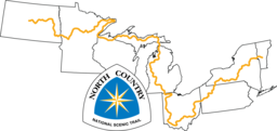
National Scenic Trail
North Country National Scenic Trail
The North Country National Scenic Trail crosses the northern United States from Lake Sakakawea in North Dakota to Crown Point, New York, linking scenic, natural, historic and cultural areas across a great variety of northern landscapes.
- Length
- 4,600 mi7,403 km
- Time
- About 8 to 12 months estimate
- GPX
- GPX hereGPX and GeoJSON
- Climb
- 342,953 ft104,532 mcomputed
-
Quehanna Trail QT
The Quehanna Trail is a loop through state forests in north-central Pennsylvania, with much of it in the Quehanna Wild Area.
PA United States
- Length
- 74 mi119 km
- Time
- About 4 to 6 days estimate
- GPX
- GPX hereGPX and GeoJSON
- Climb
- 9,688 ft2,953 mcomputed
-
Standing Stone Trail SST
The Standing Stone Trail connects the Tuscarora Trail in the south to the Mid State Trail in the north through Pennsylvania's ridge and valley country.
PA United States
- Length
- 85 mi137 km
- Time
- About 5 to 7 days estimate
- GPX
- GPX hereGPX and GeoJSON
- Climb
- 13,143 ft4,006 mcomputed
-
Susquehannock Trail System STS
The Susquehannock Trail System is a blazed loop through Potter and Clinton counties in north-central Pennsylvania.
PA United States
- Length
- 84 mi135 km
- Time
- About 5 to 7 days estimate
- GPX
- GPX hereGPX and GeoJSON
- Climb
- 12,759 ft3,889 mcomputed
-
Tuscarora Trail
The Tuscarora Trail is a long alternate to the Appalachian Trail through the Ridge and Valley Appalachians of Virginia, West Virginia, Maryland and Pennsylvania.
- Length
- 252 mi406 km
- Time
- About 2 to 3 weeks estimate
- GPX
- GPX hereGPX and GeoJSON
- Climb
- 36,371 ft11,086 mcomputed
The map needs JavaScript. The list has every trail.
- Official trail
13 tracks, simplified for display. Select one for its name. Each trail’s page names its source, credit and licence. Base map: OpenFreeMap, © OpenMapTiles, data © OpenStreetMap contributors.