A list
Lakes
Trails with lakes among their main terrain. 29 trails, 16 with a GPX here.
The map needs JavaScript. The list has every trail.
- Official trail
- Route
16 tracks, simplified for display. Select one for its name. Each trail’s page names its source, credit and licence. Base map: OpenFreeMap, © OpenMapTiles, data © OpenStreetMap contributors.
29 trails
- Official trail with a GPX here
- Route with a GPX here
- No GPX here: its page says where to get one
-
National Scenic Trail
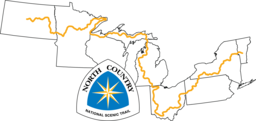
North Country National Scenic Trail NCT
The North Country National Scenic Trail crosses the northern United States from Lake Sakakawea in North Dakota to Crown Point, New York, linking scenic, natural, historic and cultural areas across a great variety of northern landscapes.
- Length
- 7,403 km4,600 mi
- Time
- About 8 to 12 months estimate
- GPX
- GPX hereGPX and GeoJSON
- Climb
- 104,532 m342,953 ftcomputed
-
Hot Springs Trail HST
Route by Aria Zoner, 2016
The Hot Springs Trail is a route from Santa Barbara, California, to the Canadian border in Idaho that links 100 wild and resort hot spring areas.
- Length
- 3,896 km2,421 mi
- Time
- About 4 months
- GPX
- Sold by its author
-
National Scenic Trail
Ice Age National Scenic Trail IAT
The Ice Age Trail is a thousand-mile footpath across Wisconsin that traces the landscape left by the last continental glacier, from Interstate State Park at St. Croix Falls to Potawatomi State Park at Sturgeon Bay.
WI United States
- Length
- 1,931 km1,200 mi
- Time
- About 2 to 3 months estimate
- GPX
- Partial GPX hereGPX and GeoJSON
Track measures 1,141.0 km of 1,931 km published
-
Voyageur Trail VT-ON
The Voyageur Trail is a work in progress along the northern Ontario shores of Lake Huron and Lake Superior, from Sudbury through Sault Ste.
ON Canada
- Length
- 1,100 km684 mi
- Time
- About 5 to 8 weeks estimate
- GPX
- Partial GPX hereGPX and GeoJSON
Track measures 2.0 km of 1,100 km published
-

Palmetto Trail PT
The Palmetto Trail crosses South Carolina from the Blue Ridge Mountains to the Intracoastal Waterway at Awendaw.
SC United States
- Length
- 800 km497 mi
- Time
- About 4 to 6 weeks estimate
- GPX
- Partial GPX hereGPX and GeoJSON
Track measures 554.3 km of 800 km published
-

Sheltowee Trace National Recreation Trail STT
The Sheltowee Trace runs the length of the Daniel Boone National Forest in Kentucky into the Big South Fork country of Tennessee.
- Length
- 515 km320 mi
- Time
- 3 to 4 weeks
- GPX
- GPX hereGPX and GeoJSON
- Climb
- 9,358 m30,702 ftcomputed
-
Superior Hiking Trail SHT
The Superior Hiking Trail tours Lake Superior's North Shore in Minnesota from south of Duluth to near the Canadian border.
MN United States
- Length
- 499 km310 mi
- Time
- 2 to 4 weeks
- GPX
- GPX hereGPX and GeoJSON
- Climb
- 10,631 m34,879 ftcomputed
-

Ozark Highlands Trail OHT
The Ozark Highlands Trail runs across northern Arkansas from Lake Fort Smith toward the Missouri border north of Norfork Lake.
AR United States
- Length
- 435 km270 mi
- Time
- About 3 to 5 weeks estimate
- GPX
- GPX hereGPX and GeoJSON
- Climb
- 10,730 m35,203 ftcomputed
-
John Muir Trail JMT
The John Muir Trail is a world-famous trail stretching from Yosemite Valley to Mount Whitney, the highest point in the contiguous United States.
CA United States
- Length
- 340 km211 mi
- Time
- About 3 weeks
- GPX
- GPX hereGPX and GeoJSON
- Climb
- 10,866 m35,650 ftcomputed
-
Sierra High Route SHR
Route by Steve Roper
The Sierra High Route is Steve Roper's timberline route through California's High Sierra from Kings Canyon National Park to northern Yosemite.
CA United States
- Length
- 314 km195 mi
- Time
- About 2 to 4 weeks estimate
- GPX
- Sold by its author
-
Tahoe–Yosemite Trail TYT
Route by Thomas Winnett, 1970
The Tahoe-Yosemite Trail is Thomas Winnett's route through California's Sierra Nevada from Meeks Bay at Lake Tahoe to Tuolumne Meadows in Yosemite National Park.
CA United States
- Length
- 299 km186 mi
- Time
- About 2 to 4 weeks estimate
- GPX
- Sold by its author
-
Tahoe Rim Trail TRT
The Tahoe Rim Trail is a loop of about 165 miles around the ridgelines of the Lake Tahoe Basin.
- Length
- 266 km165 mi
- Time
- About 2 weeks
- GPX
- GPX hereGPX and GeoJSON
- Climb
- 8,305 m27,247 ftcomputed
-
Yosemite High Route YHR
Route by Andrew Skurka
The Yosemite High Route explores the upper headwaters of the Tuolumne and Merced Rivers in Yosemite National Park, California.
CA United States
- Length
- 261 km162 mi
- Time
- 7 to 14 days
- GPX
- Sold by its author
-

Northville-Placid Trail NPT
The Northville-Placid Trail is a continuous wilderness footpath through the Adirondacks, from Waterfront Park in the village of Northville to Averyville Road in Lake Placid.
NY United States
- Length
- 220 km137 mi
- Time
- 8 to 11 days
- GPX
- GPX hereGPX and GeoJSON
- Climb
- 4,399 m14,432 ftcomputed
-
Kings Canyon High Basin Route KCHBR
Route by Andrew Skurka
The Kings Canyon High Basin Route wraps around the upper watershed of the Kings River in the High Sierra, entirely within Kings Canyon National Park.
CA United States
- Length
- 200 km124 mi
- Time
- 9 to 10 days
- GPX
- Sold by its author
-
Sunshine Coast Trail SCT
The Sunshine Coast Trail stretches from Sarah Point in Desolation Sound to Saltery Bay on British Columbia's upper Sunshine Coast.
BC Canada
- Length
- 180 km112 mi
- Time
- About 6 to 9 days estimate
- GPX
- GPX hereGPX and GeoJSON
- Climb
- 8,804 m28,885 ftcomputed
-
Uinta Highline Trail UHT
The Uinta Highline Trail traverses the Uinta Range in Utah from east to west, mostly above 10,000 feet in the High Uintas Wilderness.
UT United States
- Length
- 167 km104 mi
- Time
- About 6 to 9 days estimate
- GPX
- GPX hereGPX and GeoJSON
- Climb
- 5,003 m16,414 ftcomputed
-
Southern Sierra High Route SoSHR
Route by Alan Dixon and Don Wilson, 2014
The Southern Sierra High Route traverses the highest part of California's Sierra Nevada from the South Lake trailhead near Bishop to Cottonwood Lakes.
CA United States
- Length
- 161 km100 mi
- Time
- 5 to 6 days
- GPX
- Free from its author
-
North Boundary Trail NBT
The North Boundary Trail is a remote wilderness route along the northern edge of Jasper National Park, from Rock Lake over Snake Indian Pass and down the Smoky River to Mount Robson Provincial Park in British Columbia.
AB Canada
- Length
- 159 km99 mi
- Time
- 7 to 10 days
- GPX
- See the official site
-
Wind River High Route (Skurka guide) WRHR
Route by Andrew Skurka
Andrew Skurka's Wind River High Route follows the alpine crest of Wyoming's Wind River Range between Wind River Peak in the south and Downs Mountain in the north.
WY United States
- Length
- 156 km97 mi
- Time
- About 8 to 13 days estimate
- GPX
- Sold by its author
-
Sawtooth Wilderness High Route SWHR
Route by the author of the SeekingLost blog, 2017
This Sawtooth Wilderness high route loops from the Tin Cup Trailhead at Pettit Lake in Idaho, staying as high as possible among the range's lakes and passes.
ID United States
- Length
- 143 km89 mi
- Time
- About 8 to 12 days estimate
- GPX
- Free from its author
-
Wind River High Route (Dixon and Wilson) WRHR-DW
Route by Alan Dixon and Don Wilson
Alan Dixon and Don Wilson's Wind River High Route runs from the Green River Lakes trailhead in Wyoming generally southeast along the Continental Divide to the Big Sandy trailhead.
WY United States
- Length
- 129 km80 mi
- Time
- 7 days
- GPX
- Free from its author
-
Pfiffner Traverse PT
Route by Andrew Skurka
The Pfiffner Traverse follows the Continental Divide and the crest of Colorado's Front Range between Trail Ridge Road and Berthoud Pass.
CO United States
- Length
- 124 km77 mi
- Time
- 6 to 10 days
- GPX
- Sold by its author
-
Sunapee-Ragged-Kearsarge Greenway SRKG
The Sunapee Ragged Kearsarge Greenway is a circle of trails in central New Hampshire encircling the Lake Sunapee area.
NH United States
- Length
- 121 km75 mi
- Time
- About 5 to 7 days estimate
- GPX
- GPX hereGPX and GeoJSON
- Climb
- 4,160 m13,648 ftcomputed
-
Border Route Trail BRT
The Border Route Trail is a wilderness hiking trail along the Minnesota and Ontario border, inside the Boundary Waters Canoe Area Wilderness in northeast Minnesota.
MN United States
- Length
- 105 km65 mi
- Time
- About 4 to 6 days estimate
- GPX
- GPX hereGPX and GeoJSON
- Climb
- 2,521 m8,271 ftcomputed
-
Cranberry Lake 50 CL50
The Cranberry Lake 50 is a loop of about 50 miles around Cranberry Lake in the Adirondacks of New York.
NY United States
- Length
- 80 km50 mi
- Time
- 3 to 5 days
- GPX
- GPX hereGPX and GeoJSON
- Climb
- 1,150 m3,773 ftcomputed
-
La Cloche Silhouette Trail LCS
The La Cloche Silhouette Trail is a loop in Killarney Provincial Park, a wilderness landscape of the La Cloche Mountains' white quartzite ridges, the pink granite coast of Georgian Bay and more than fifty exceptionally clear sapphire lakes.
ON Canada
- Length
- 80 km50 mi
- Time
- 7 to 10 days
- GPX
- GPX hereGPX and GeoJSON
- Climb
- 2,079 m6,821 ftcomputed
-
Kekekabic Trail KEK
The Kekekabic Trail is a primitive trail across the heart of the Boundary Waters Canoe Area Wilderness in northern Minnesota, from Snowbank Lake near Ely to the Gunflint Trail.
MN United States
- Length
- 66 km41 mi
- Time
- About 3 to 4 days estimate
- GPX
- See the official site
-
Teton Crest Trail TCT-WY
The Teton Crest Trail is a point to point route along the crest of the Teton Range in Wyoming, starting outside Grand Teton National Park at Phillips Pass and ending at String Lake.
WY United States
- Length
- 64 km40 mi
- Time
- About 3 to 4 days estimate
- GPX
- See the official site
Lists are picked out by rule from each trail’s facts, so they change as trails are added or corrected. A list is shown when it has at least 4 trails and no more than 75% of the 138.