A list
Forest
Trails with forest among their main terrain. 76 trails, 56 with a GPX here.
The map needs JavaScript. The list has every trail.
- Official trail
- Route
56 tracks, simplified for display. Select one for its name. Each trail’s page names its source, credit and licence. Base map: OpenFreeMap, © OpenMapTiles, data © OpenStreetMap contributors.
76 trails
- Official trail with a GPX here
- Route with a GPX here
- No GPX here: its page says where to get one
-
Great Western Loop GWL
Route by Andrew Skurka and Ryan Jordan, 2006
The Great Western Loop links the Pacific Crest, Pacific Northwest, Continental Divide, Grand Enchantment and Arizona trails together with a trail-less stretch through the Sonoran and Mojave Deserts into one circuit of the American West.
- Length
- 11,064 km6,875 mi
- Time
- About 7 months
- GPX
- Not published
-
National Scenic Trail
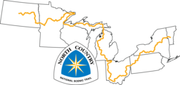
North Country National Scenic Trail NCT
The North Country National Scenic Trail crosses the northern United States from Lake Sakakawea in North Dakota to Crown Point, New York, linking scenic, natural, historic and cultural areas across a great variety of northern landscapes.
- Length
- 7,403 km4,600 mi
- Time
- About 8 to 12 months estimate
- GPX
- GPX hereGPX and GeoJSON
- Climb
- 104,532 m342,953 ftcomputed
-
Great Western Trail GWT
The Great Western Trail is a multi-use corridor running north to south from Canada to Mexico through Arizona, Utah, Idaho, Wyoming and Montana.
- Length
- 4,800 km2,983 mi
- Time
- About 5 to 8 months estimate
- GPX
- See the official site
-

National Scenic Trail
Pacific Crest National Scenic Trail PCT
The Pacific Crest Trail runs from the Mexican border to the Canadian border along the mountain ranges of California, Oregon and Washington.
- Length
- 4,265 km2,650 mi
- Time
- About 5 to 7 months estimate
- GPX
- GPX hereGPX and GeoJSON
- Climb
- 135,030 m443,012 ftcomputed
-

National Scenic Trail
Appalachian National Scenic Trail AT
The Appalachian Trail follows the Appalachian Mountains from Springer Mountain in Georgia to Katahdin in Maine.
- Length
- 3,537 km2,198 mi
- Time
- 5 to 7 months
- GPX
- GPX hereGPX and GeoJSON
- Climb
- 142,218 m466,594 ftcomputed
-

Buckeye Trail BT
The Buckeye Trail is a continuous loop around the state of Ohio, with no beginning or end.
OH United States
- Length
- 2,250 km1,398 mi
- Time
- About 2 to 4 months estimate
- GPX
- GPX hereGPX and GeoJSON
- Climb
- 28,469 m93,402 ftcomputed
-

National Scenic Trail
Ice Age National Scenic Trail IAT
The Ice Age Trail is a thousand-mile footpath across Wisconsin that traces the landscape left by the last continental glacier, from Interstate State Park at St. Croix Falls to Potawatomi State Park at Sturgeon Bay.
WI United States
- Length
- 1,931 km1,200 mi
- Time
- About 2 to 3 months estimate
- GPX
- Partial GPX hereGPX and GeoJSON
Track measures 1,141.0 km of 1,931 km published
-

National Scenic Trail
Pacific Northwest National Scenic Trail PNT
The Pacific Northwest Trail runs east to west from Chief Mountain in Glacier National Park, Montana, to Cape Alava in Olympic National Park, Washington.
- Length
- 1,931 km1,200 mi
- Time
- About 2 months
- GPX
- GPX hereGPX and GeoJSON
- Climb
- 66,605 m218,520 ftcomputed
-

Mountains-to-Sea Trail MST-NC
The Mountains-to-Sea Trail stretches across North Carolina from the Great Smoky Mountains to the Outer Banks, taking in mountain vistas, rolling Piedmont farms, hardwood and pine forests, coastal swamps, lighthouses, sand dunes and miles of seashore.
NC United States
- Length
- 1,890 km1,174 mi
- Time
- 3 to 4 months
- GPX
- GPX hereGPX and GeoJSON
- Climb
- 27,574 m90,466 ftcomputed
-
Sentier National (Quebec) SN
Le Sentier national au Québec runs from Gatineau to the tip of Forillon National Park in the Gaspésie, crossing nine tourist regions of Quebec.
QC Canada
- Length
- 1,500 km932 mi
- Time
- About 2 months estimate
- GPX
- Partial GPX hereGPX and GeoJSON
Track measures 788.8 km of 1,500 km published
-
Idaho Centennial Trail ICT
The Idaho Centennial Trail is the state trail of Idaho, running from Murphy Hot Springs on the Nevada border north through mountains and high desert to the state's northern boundary.
ID United States
- Length
- 1,448 km900 mi
- Time
- About 2 months estimate
- GPX
- Partial GPX hereGPX and GeoJSON
Track measures 292.5 km of 1,448 km published
-

National Scenic Trail
Arizona National Scenic Trail AZT
The Arizona National Scenic Trail crosses Arizona from the Mexico border to the Utah border.
AZ United States
- Length
- 1,287 km800 mi
- Time
- 6 to 9 weeks
- GPX
- GPX hereGPX and GeoJSON
- Climb
- 31,724 m104,081 ftcomputed
-

Grand Enchantment Trail GET
The Grand Enchantment Trail is a route of over 770 miles from the edge of Phoenix in Arizona to the edge of Albuquerque in New Mexico.
- Length
- 1,239 km770 mi
- Time
- About 2 to 3 months estimate
- GPX
- See the official site
-

Sentier international des Appalaches (International Appalachian Trail, Quebec and New Brunswick) IAT-CA
The Sentier international des Appalaches listed here runs from Perth-Andover in New Brunswick to Forillon National Park in Quebec.
- Length
- 1,177 km731 mi
- Time
- About 6 to 8 weeks estimate
- GPX
- GPX hereGPX and GeoJSON
- Climb
- 29,499 m96,781 ftcomputed
-

Great Divide Trail GDT
The Great Divide Trail follows the Continental Divide through Alberta and British Columbia, from Waterton Lakes National Park at the United States border to Kakwa Lake.
- Length
- 1,130 km702 mi
- Time
- About 8 weeks
- GPX
- GPX hereGPX and GeoJSON
- Climb
- 37,307 m122,398 ftcomputed
-

Voyageur Trail VT-ON
The Voyageur Trail is a work in progress along the northern Ontario shores of Lake Huron and Lake Superior, from Sudbury through Sault Ste.
ON Canada
- Length
- 1,100 km684 mi
- Time
- About 5 to 8 weeks estimate
- GPX
- Partial GPX hereGPX and GeoJSON
Track measures 2.0 km of 1,100 km published
-
Blue Mountains Trail BMT
Route by Greater Hells Canyon Council, 2021
The Blue Mountains Trail is a long hiking route through northeast Oregon, from Joseph to John Day.
OR United States
- Length
- 853 km530 mi
- Time
- About 1 to 2 months estimate
- GPX
- Free from its author
-
Sky Islands Traverse SIT
Route by Brett Tucker ("Blisterfree"), 2011
The Sky Islands Traverse makes a circuitous journey across ten forest-clad mountain ranges of southeast Arizona, separated by grassland and desert valleys.
AZ United States
- Length
- 837 km520 mi
- Time
- About 1 to 2 months estimate
- GPX
- Not published
-
Mogollon Rim Trail MRT
Route by Brett Tucker ("Blisterfree")
The Mogollon Rim Trail is a route across Arizona's Rim Country, from the Parsons Trailhead outside Cottonwood through Sedona's redrock country, the Highline Trail, the White Mountains and the Blue Range to the New Mexico border, where it joins the Grand Enchantment Trail near Alma.
- Length
- 805 km500 mi
- Time
- About 1 to 2 months estimate
- GPX
- Sold by its author
-
Northern New Mexico Loop NNML
Route by Brett Tucker ("Blisterfree") and collaborators
The Northern New Mexico Loop starts and ends at Santa Fe Plaza, touring the Jemez Mountains, the Continental Divide and the Sangre de Cristo Mountains on a clockwise circuit of northern New Mexico.
NM United States
- Length
- 805 km500 mi
- Time
- About 1 to 2 months estimate
- GPX
- Sold by its author
-

Palmetto Trail PT
The Palmetto Trail crosses South Carolina from the Blue Ridge Mountains to the Intracoastal Waterway at Awendaw.
SC United States
- Length
- 800 km497 mi
- Time
- About 4 to 6 weeks estimate
- GPX
- Partial GPX hereGPX and GeoJSON
Track measures 554.3 km of 800 km published
-
Vancouver Island Trail VIT
The Vancouver Island Trail runs the length of Vancouver Island in British Columbia from Victoria in the south to Cape Scott on the northern tip.
BC Canada
- Length
- 800 km497 mi
- Time
- 4 to 9 weeks
- GPX
- GPX hereGPX and GeoJSON
- Climb
- 18,681 m61,289 ftcomputed
-
Oregon Coast Trail OCT
The Oregon Coast Trail follows the Oregon coastline, crossing sandy beaches, forest-shaded corridors, majestic headlands and 28 coastal towns.
OR United States
- Length
- 650 km404 mi
- Time
- About 3 to 5 weeks estimate
- GPX
- GPX hereGPX and GeoJSON
- Climb
- 10,101 m33,140 ftcomputed
-

Overmountain Victory National Historic Trail OVNHT
The Overmountain Victory National Historic Trail is a 330-mile route through Virginia, Tennessee, North Carolina and South Carolina tracing the march of the Patriot militia to the pivotal Battle of Kings Mountain in 1780.
- Length
- 540 km336 mi
- Time
- About 3 to 4 weeks estimate
- GPX
- See the official site
-

Pinhoti Trail PIN
The Pinhoti Trail is a Southern Appalachian long-distance trail through Alabama and Georgia.
- Length
- 540 km336 mi
- Time
- About 3 to 4 weeks estimate
- GPX
- GPX hereGPX and GeoJSON
- Climb
- 13,863 m45,482 ftcomputed
-

Allegheny Trail ALT
The Allegheny Trail runs south through West Virginia from the Mason-Dixon Line at the Pennsylvania border to the Appalachian Trail on Peters Mountain, near the Virginia border.
WV United States
- Length
- 530 km329 mi
- Time
- About 3 to 4 weeks estimate
- GPX
- Partial GPX hereGPX and GeoJSON
Track measures 28.8 km of 530 km published
-
Mid State Trail MST-PA
The Mid State Trail stretches from near Flintstone, Maryland, through the center of Pennsylvania to the New York State line just north of Cowanesque Lake, crossing four regions from south to north.
PA United States
- Length
- 515 km320 mi
- Time
- About 3 to 4 weeks estimate
- GPX
- GPX hereGPX and GeoJSON
- Climb
- 15,106 m49,560 ftcomputed
-

Sheltowee Trace National Recreation Trail STT
The Sheltowee Trace runs the length of the Daniel Boone National Forest in Kentucky into the Big South Fork country of Tennessee.
- Length
- 515 km320 mi
- Time
- 3 to 4 weeks
- GPX
- GPX hereGPX and GeoJSON
- Climb
- 9,358 m30,702 ftcomputed
-
Superior Hiking Trail SHT
The Superior Hiking Trail tours Lake Superior's North Shore in Minnesota from south of Duluth to near the Canadian border.
MN United States
- Length
- 499 km310 mi
- Time
- 2 to 4 weeks
- GPX
- GPX hereGPX and GeoJSON
- Climb
- 10,631 m34,879 ftcomputed
-

Benton MacKaye Trail BMT
The Benton MacKaye Trail starts on Springer Mountain in Georgia, shared with the Appalachian Trail, and runs north through Tennessee and North Carolina to Big Creek in the Great Smoky Mountains.
- Length
- 463 km288 mi
- Time
- 3 to 4 weeks
- GPX
- GPX hereGPX and GeoJSON
- Climb
- 19,008 m62,362 ftcomputed
-
Wasatch Traverse WT
Route by Liz Thomas
The Wasatch Traverse follows the length of Utah's Wasatch Range from the Wellsville Wilderness in the north to the southwest side of the Mount Nebo Wilderness.
UT United States
- Length
- 455 km283 mi
- Time
- 11 days
- GPX
- Free from its author
-

Long Trail (Vermont) LT
The Long Trail runs the length of Vermont along the Green Mountains, from the Massachusetts border to the Canadian border.
VT United States
- Length
- 438 km272 mi
- Time
- 3 to 4 weeks
- GPX
- GPX hereGPX and GeoJSON
- Climb
- 20,353 m66,775 ftcomputed
-

Ozark Highlands Trail OHT
The Ozark Highlands Trail runs across northern Arkansas from Lake Fort Smith toward the Missouri border north of Norfork Lake.
AR United States
- Length
- 435 km270 mi
- Time
- About 3 to 5 weeks estimate
- GPX
- GPX hereGPX and GeoJSON
- Climb
- 10,730 m35,203 ftcomputed
-
Tuscarora Trail TT
The Tuscarora Trail is a long alternate to the Appalachian Trail through the Ridge and Valley Appalachians of Virginia, West Virginia, Maryland and Pennsylvania.
- Length
- 406 km252 mi
- Time
- About 2 to 3 weeks estimate
- GPX
- GPX hereGPX and GeoJSON
- Climb
- 11,086 m36,371 ftcomputed
-
Trans Adirondack Route TAR
Route by Erik Schlimmer, 2010
The Trans Adirondack Route crosses the whole Adirondack Park in New York from its southern blue line to its northern one.
NY United States
- Length
- 391 km243 mi
- Time
- About 3 to 5 weeks estimate
- GPX
- Sold by its author
-

National Scenic Trail
New England National Scenic Trail NET
The New England Trail runs from Long Island Sound in Connecticut across long ridges to the Massachusetts-New Hampshire border, passing through 41 communities along the way.
- Length
- 378 km235 mi
- Time
- 2 to 4 weeks
- GPX
- GPX hereGPX and GeoJSON
- Climb
- 11,011 m36,125 ftcomputed
-
Ouachita National Recreation Trail OT
The Ouachita National Recreation Trail stretches through the Ouachita Mountains of Arkansas and Oklahoma, from Talimena State Park through Queen Wilhelmina State Park to Pinnacle Mountain State Park near Little Rock.
- Length
- 359 km223 mi
- Time
- About 2 to 3 weeks estimate
- GPX
- GPX hereGPX and GeoJSON
- Climb
- 9,947 m32,635 ftcomputed
-
Mason-Dixon Trail MDT
The Mason-Dixon Trail connects the Appalachian Trail with the Brandywine Trail, starting at Whiskey Springs in Cumberland County, Pennsylvania, following the Susquehanna River to Havre de Grace, Maryland, then running through Delaware and ending at Chadds Ford, Pennsylvania, on the Brandywine River.
- Length
- 311 km193 mi
- Time
- About 2 weeks estimate
- GPX
- GPX hereGPX and GeoJSON
- Climb
- 5,832 m19,134 ftcomputed
-
Tahoe–Yosemite Trail TYT
Route by Thomas Winnett, 1970
The Tahoe-Yosemite Trail is Thomas Winnett's route through California's Sierra Nevada from Meeks Bay at Lake Tahoe to Tuolumne Meadows in Yosemite National Park.
CA United States
- Length
- 299 km186 mi
- Time
- About 2 to 4 weeks estimate
- GPX
- Sold by its author
-
Highlands Trail HT
The Highlands Trail runs across the New Jersey and New York Highlands, connecting the Delaware and Hudson rivers, with continuations into Pennsylvania and Connecticut.
- Length
- 290 km180 mi
- Time
- About 1 to 2 weeks estimate
- GPX
- GPX hereGPX and GeoJSON
- Climb
- 7,554 m24,783 ftcomputed
-

Cohos Trail COHOS
The Cohos Trail runs north through New Hampshire from southern Crawford Notch to the Canadian border at Pittsburg, through the White Mountains and the Great North Woods.
NH United States
- Length
- 270 km168 mi
- Time
- 9 to 14 days
- GPX
- GPX hereGPX and GeoJSON
- Climb
- 9,834 m32,264 ftcomputed
-
Oak Ridges Trail ORT
The Oak Ridges Trail is a walking route along the Oak Ridges Moraine, from the Bruce Trail at Glen Haffy Conservation Area east of Caledon through forested tracts, conservation areas and country road allowances to the Castleton and Warkworth area of Northumberland County.
ON Canada
- Length
- 270 km168 mi
- Time
- About 9 to 14 days estimate
- GPX
- GPX hereGPX and GeoJSON
- Climb
- 3,153 m10,344 ftcomputed
-

Tahoe Rim Trail TRT
The Tahoe Rim Trail is a loop of about 165 miles around the ridgelines of the Lake Tahoe Basin.
- Length
- 266 km165 mi
- Time
- About 2 weeks
- GPX
- GPX hereGPX and GeoJSON
- Climb
- 8,305 m27,247 ftcomputed
-
Yosemite High Route YHR
Route by Andrew Skurka
The Yosemite High Route explores the upper headwaters of the Tuolumne and Merced Rivers in Yosemite National Park, California.
CA United States
- Length
- 261 km162 mi
- Time
- 7 to 14 days
- GPX
- Sold by its author
-
River to River Trail R2R
The River to River Trail spans southern Illinois from the Ohio River to the Mississippi River, mostly in the Shawnee National Forest.
IL United States
- Length
- 257 km160 mi
- Time
- About 9 to 13 days estimate
- GPX
- GPX hereGPX and GeoJSON
- Climb
- 4,526 m14,849 ftcomputed
-

Northville-Placid Trail NPT
The Northville-Placid Trail is a continuous wilderness footpath through the Adirondacks, from Waterfront Park in the village of Northville to Averyville Road in Lake Placid.
NY United States
- Length
- 220 km137 mi
- Time
- 8 to 11 days
- GPX
- GPX hereGPX and GeoJSON
- Climb
- 4,399 m14,432 ftcomputed
-
Baker Trail BT
The Baker Trail is a hiking and backpacking trail north of Pittsburgh that runs through western Pennsylvania to Forest County.
PA United States
- Length
- 216 km134 mi
- Time
- About 8 to 11 days estimate
- GPX
- GPX hereGPX and GeoJSON
- Climb
- 4,664 m15,302 ftcomputed
-
Sunshine Coast Trail SCT
The Sunshine Coast Trail stretches from Sarah Point in Desolation Sound to Saltery Bay on British Columbia's upper Sunshine Coast.
BC Canada
- Length
- 180 km112 mi
- Time
- About 6 to 9 days estimate
- GPX
- GPX hereGPX and GeoJSON
- Climb
- 8,804 m28,885 ftcomputed
-
Uinta Highline Trail UHT
The Uinta Highline Trail traverses the Uinta Range in Utah from east to west, mostly above 10,000 feet in the High Uintas Wilderness.
UT United States
- Length
- 167 km104 mi
- Time
- About 6 to 9 days estimate
- GPX
- GPX hereGPX and GeoJSON
- Climb
- 5,003 m16,414 ftcomputed
-
North Boundary Trail NBT
The North Boundary Trail is a remote wilderness route along the northern edge of Jasper National Park, from Rock Lake over Snake Indian Pass and down the Smoky River to Mount Robson Provincial Park in British Columbia.
AB Canada
- Length
- 159 km99 mi
- Time
- 7 to 10 days
- GPX
- See the official site
-
Lone Star Hiking Trail LSHT
The Lone Star Hiking Trail is a footpath-only route meandering across the breadth of the Sam Houston National Forest in East Texas, from near Richards east to near Cleveland.
TX United States
- Length
- 155 km96 mi
- Time
- About 6 to 8 days estimate
- GPX
- GPX hereGPX and GeoJSON
- Climb
- 1,042 m3,419 ftcomputed
-
Wonderland Trail WT
The Wonderland Trail is a loop of about 93 miles that goes all the way around Mount Rainier in Washington.
WA United States
- Length
- 150 km93 mi
- Time
- 10 to 14 days
- GPX
- GPX hereGPX and GeoJSON
- Climb
- 7,500 m24,606 ftcomputed
-
Standing Stone Trail SST
The Standing Stone Trail connects the Tuscarora Trail in the south to the Mid State Trail in the north through Pennsylvania's ridge and valley country.
PA United States
- Length
- 137 km85 mi
- Time
- About 5 to 7 days estimate
- GPX
- GPX hereGPX and GeoJSON
- Climb
- 4,006 m13,143 ftcomputed
-
Susquehannock Trail System STS
The Susquehannock Trail System is a blazed loop through Potter and Clinton counties in north-central Pennsylvania.
PA United States
- Length
- 135 km84 mi
- Time
- About 5 to 7 days estimate
- GPX
- GPX hereGPX and GeoJSON
- Climb
- 3,889 m12,759 ftcomputed
-
North-South Trail NST
The North-South Trail is a hiking trail that runs through the state of Rhode Island, crossing state parks and management areas on land of many owners.
RI United States
- Length
- 125 km78 mi
- Time
- About 5 to 7 days estimate
- GPX
- GPX hereGPX and GeoJSON
- Climb
- 1,330 m4,364 ftcomputed
-
Pfiffner Traverse PT
Route by Andrew Skurka
The Pfiffner Traverse follows the Continental Divide and the crest of Colorado's Front Range between Trail Ridge Road and Berthoud Pass.
CO United States
- Length
- 124 km77 mi
- Time
- 6 to 10 days
- GPX
- Sold by its author
-

Foothills Trail FHT
The Foothills Trail is a long backpacking trail through the mountains of upstate South Carolina and western North Carolina.
- Length
- 122 km76 mi
- Time
- 5 to 10 days
- GPX
- GPX hereGPX and GeoJSON
- Climb
- 4,064 m13,333 ftcomputed
-
South Boundary Trail SBT
The South Boundary Trail is a remote wilderness route in Jasper National Park, Alberta, recommended only for experienced backpackers.
AB Canada
- Length
- 121 km75 mi
- Time
- 7 to 10 days
- GPX
- See the official site
-
Sunapee-Ragged-Kearsarge Greenway SRKG
The Sunapee Ragged Kearsarge Greenway is a circle of trails in central New Hampshire encircling the Lake Sunapee area.
NH United States
- Length
- 121 km75 mi
- Time
- About 5 to 7 days estimate
- GPX
- GPX hereGPX and GeoJSON
- Climb
- 4,160 m13,648 ftcomputed
-
Quehanna Trail QT
The Quehanna Trail is a loop through state forests in north-central Pennsylvania, with much of it in the Quehanna Wild Area.
PA United States
- Length
- 119 km74 mi
- Time
- About 4 to 6 days estimate
- GPX
- GPX hereGPX and GeoJSON
- Climb
- 2,953 m9,688 ftcomputed
-
High Sierra Trail HST
The High Sierra Trail leads from Crescent Meadow in Sequoia National Park over the Great Western Divide at Kaweah Gap and down to the Kern River canyon, joining the John Muir Trail for the climb to Mount Whitney.
CA United States
- Length
- 116 km72 mi
- Time
- 6 to 7 days
- GPX
- Partial GPX hereGPX and GeoJSON
Track measures 77.4 km of 116 km published
-
Laurel Highlands Hiking Trail LHHT
The Laurel Highlands Hiking Trail stretches along Laurel Mountain from the Youghiogheny River at Ohiopyle State Park to the Conemaugh Gorge near Johnstown.
PA United States
- Length
- 113 km70 mi
- Time
- 8 days
- GPX
- GPX hereGPX and GeoJSON
- Climb
- 3,755 m12,320 ftcomputed
-
Border Route Trail BRT
The Border Route Trail is a wilderness hiking trail along the Minnesota and Ontario border, inside the Boundary Waters Canoe Area Wilderness in northeast Minnesota.
MN United States
- Length
- 105 km65 mi
- Time
- About 4 to 6 days estimate
- GPX
- GPX hereGPX and GeoJSON
- Climb
- 2,521 m8,271 ftcomputed
-
Mattabesett Trail MTB
The Mattabesett Trail is a blue-blazed trail in central Connecticut that runs in a large horseshoe from River Road in Middletown to the Berlin Turnpike in Berlin.
CT United States
- Length
- 105 km65 mi
- Time
- About 4 to 6 days estimate
- GPX
- GPX hereGPX and GeoJSON
- Climb
- 2,721 m8,927 ftcomputed
-

National Scenic Trail
Natchez Trace National Scenic Trail NATT
The Natchez Trace National Scenic Trail is made up of five separate sections of hiking and equestrian trail, together a little over 60 miles, running roughly parallel to the 444-mile Natchez Trace Parkway from Natchez, Mississippi, to south of Nashville, Tennessee.
- Length
- 105 km65 mi
- Time
- About 4 to 6 days estimate
- GPX
- GPX hereGPX and GeoJSON
- Climb
- 1,500 m4,921 ftcomputed
-
Corvallis-to-the-Sea Trail C2C
The Corvallis-to-the-Sea Trail links the Willamette Valley with the Pacific Ocean, from Corvallis to Ona Beach in Oregon.
OR United States
- Length
- 97 km60 mi
- Time
- 5 to 6 days
- GPX
- GPX hereGPX and GeoJSON
- Climb
- 2,522 m8,274 ftcomputed
-
Loyalsock Trail LT
The Loyalsock Trail is an end-to-end trail through the Loyalsock State Forest in northern Pennsylvania, from PA Route 87 north of Montoursville to Mead Road near Laporte, with the remainder on private land.
PA United States
- Length
- 95 km59 mi
- Time
- About 4 to 5 days estimate
- GPX
- GPX hereGPX and GeoJSON
- Climb
- 3,533 m11,591 ftcomputed
-
Sequoia Great Western Divide Loop GWDL
Route by Brian Lucido, 2013
The Sequoia Great Western Divide Loop is a backpacking loop from Crescent Meadow in Sequoia National Park that crosses the Great Western Divide at Kaweah Gap, past Precipice Lake and the Hamilton Lakes.
CA United States
- Length
- 93 km58 mi
- Time
- About 4 to 5 days estimate
- GPX
- Free from its author
-
Batona Trail BT
The Batona Trail is a long trail through the New Jersey Pinelands that links three state forests: Brendan T. Byrne, Wharton and Bass River.
NJ United States
- Length
- 80 km50 mi
- Time
- About 3 to 4 days estimate
- GPX
- GPX hereGPX and GeoJSON
- Climb
- 203 m666 ftcomputed
-
Cranberry Lake 50 CL50
The Cranberry Lake 50 is a loop of about 50 miles around Cranberry Lake in the Adirondacks of New York.
NY United States
- Length
- 80 km50 mi
- Time
- 3 to 5 days
- GPX
- GPX hereGPX and GeoJSON
- Climb
- 1,150 m3,773 ftcomputed
-
La Cloche Silhouette Trail LCS
The La Cloche Silhouette Trail is a loop in Killarney Provincial Park, a wilderness landscape of the La Cloche Mountains' white quartzite ridges, the pink granite coast of Georgian Bay and more than fifty exceptionally clear sapphire lakes.
ON Canada
- Length
- 80 km50 mi
- Time
- 7 to 10 days
- GPX
- GPX hereGPX and GeoJSON
- Climb
- 2,079 m6,821 ftcomputed
-
Monadnock-Sunapee Greenway MSG
The Monadnock-Sunapee Greenway is a hiking trail linking Grand Monadnock with Mount Sunapee, winding along the Monadnock Highlands that divide the Connecticut and Merrimack river drainages in southwestern New Hampshire.
NH United States
- Length
- 80 km50 mi
- Time
- 3 to 4 days
- GPX
- GPX hereGPX and GeoJSON
- Climb
- 2,747 m9,012 ftcomputed
-
West Coast Trail WCT
The West Coast Trail runs 75 kilometres through Pacific Rim National Park Reserve in British Columbia, from Pachena Bay in the north to Gordon River in the south.
BC Canada
- Length
- 75 km47 mi
- Time
- 6 to 8 days
- GPX
- See the official site
-
Kekekabic Trail KEK
The Kekekabic Trail is a primitive trail across the heart of the Boundary Waters Canoe Area Wilderness in northern Minnesota, from Snowbank Lake near Ely to the Gunflint Trail.
MN United States
- Length
- 66 km41 mi
- Time
- About 3 to 4 days estimate
- GPX
- See the official site
-
Timberline Trail (Mount Hood) TLT
The Timberline Trail circumnavigates Mount Hood in Oregon at or near tree line, entering the Mount Hood Wilderness.
OR United States
- Length
- 64 km40 mi
- Time
- 3 to 4 days
- GPX
- See the official site
-
Pukaskwa Coastal Hiking Trail PCHT
The Coastal Hiking Trail follows the Lake Superior shore in Pukaskwa National Park, Ontario.
ON Canada
- Length
- 60 km37 mi
- Time
- About 2 to 3 days estimate
- GPX
- See the official site
Lists are picked out by rule from each trail’s facts, so they change as trails are added or corrected. A list is shown when it has at least 4 trails and no more than 75% of the 138.