 Long Hikes
New York
Hiking Trails with a GPX in New York
Trails with a GPX file of the track on their page. 11 of the 15 trails in New York, 11 with a GPX here. All the trails in New York.
The longest is North Country Trail, 4,600 miles (7,403 km). The shortest is Cranberry Lake 50, 50 miles (80 km). 1 loop.
The quickest to walk whole is Bristol Hills Trail, about 3 to 5 days, and the slowest is North Country Trail, about 8 to 12 months. Terrain is on file for 8 of them; the most common is forest (8), lakes (3), alpine (1) and coast (1). By designation: National Scenic Trails (2) and Clubs and associations (7). The highest point stated is 6,624 ft2,019 m, on Appalachian Trail.
11 trails
- Official trail with a GPX here
- Route with a GPX here
- No GPX here: its page says where to get one
-
National Scenic Trail
Appalachian National Scenic Trail AT
The Appalachian Trail follows the Appalachian Mountains from Springer Mountain in Georgia to Katahdin in Maine.
- Length
- 2,198 mi3,537 km
- Time
- 5 to 7 months
- GPX
- GPX hereGPX and GeoJSON
- Climb
- 466,594 ft142,218 mcomputed
-
Bristol Hills Trail
The Bristol Hills Trail is a branch trail of the Finger Lakes Trail in New York.
NY United States
- Length
- 55 mi89 km
- Time
- About 3 to 5 days estimate
- GPX
- GPX hereGPX and GeoJSON
- Climb
- 8,720 ft2,658 mcomputed
-
Cranberry Lake 50 CL50
The Cranberry Lake 50 is a loop of about 50 miles around Cranberry Lake in the Adirondacks of New York.
NY United States
- Length
- 50 mi80 km
- Time
- 3 to 5 days
- GPX
- GPX hereGPX and GeoJSON
- Climb
- 3,773 ft1,150 mcomputed
-

Finger Lakes Trail FLT
The Finger Lakes Trail crosses southern New York from the Pennsylvania border in Allegany State Park to the Long Path and Slide Mountain in the Catskills.
NY United States
- Length
- 580 mi933 km
- Time
- About 5 to 7 weeks estimate
- GPX
- GPX hereGPX and GeoJSON
- Climb
- 89,229 ft27,197 mcomputed
-

Great Eastern Trail GET
The Great Eastern Trail links existing trails into a long footpath through the Appalachian Mountains, from Alabama to the Finger Lakes Trail in New York.
- Length
- 1,800 mi2,897 km
- Time
- About 3 to 5 months estimate
- GPX
- Partial GPX hereGPX and GeoJSON
Track measures 1,459 mi2,348.2 km of 1,800 mi2,897 km published
-

Highlands Trail
The Highlands Trail runs across the New Jersey and New York Highlands, connecting the Delaware and Hudson rivers, with continuations into Pennsylvania and Connecticut.
- Length
- 180 mi290 km
- Time
- About 1 to 2 weeks estimate
- GPX
- GPX hereGPX and GeoJSON
- Climb
- 24,783 ft7,554 mcomputed
-

Long Path LP
The Long Path is a long-distance trail that stretches from the George Washington Bridge in New York City to the rugged wilderness of upstate New York.
- Length
- 358 mi576 km
- Time
- About 3 to 4 weeks estimate
- GPX
- GPX hereGPX and GeoJSON
Track measures 419 mi674.0 km against 358 mi576 km published
-
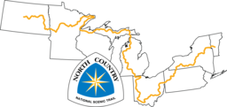
National Scenic Trail
North Country National Scenic Trail
The North Country National Scenic Trail crosses the northern United States from Lake Sakakawea in North Dakota to Crown Point, New York, linking scenic, natural, historic and cultural areas across a great variety of northern landscapes.
- Length
- 4,600 mi7,403 km
- Time
- About 8 to 12 months estimate
- GPX
- GPX hereGPX and GeoJSON
- Climb
- 342,953 ft104,532 mcomputed
-
Northville-Placid Trail NPT
The Northville-Placid Trail is a continuous wilderness footpath through the Adirondacks, from Waterfront Park in the village of Northville to Averyville Road in Lake Placid.
NY United States
- Length
- 137 mi220 km
- Time
- 8 to 11 days
- GPX
- GPX hereGPX and GeoJSON
- Climb
- 14,432 ft4,399 mcomputed
-
Paumanok Path
The Paumanok Path is a regional trail across Long Island, New York, from Rocky Point in Brookhaven Town to Montauk Point on the Atlantic Ocean in East Hampton Town.
NY United States
- Length
- 125 mi201 km
- Time
- About 7 to 11 days estimate
- GPX
- GPX hereGPX and GeoJSON
- Climb
- 6,056 ft1,846 mcomputed
-
Shawangunk Ridge Trail SRT
The Shawangunk Ridge Trail starts at the Appalachian Trail in High Point State Park in New Jersey and runs north along the Shawangunk Ridge in New York to Mohonk Preserve.
- Length
- 71 mi114 km
- Time
- About 4 to 6 days estimate
- GPX
- GPX hereGPX and GeoJSON
- Climb
- 10,010 ft3,051 mcomputed
The map needs JavaScript. The list has every trail.
- Official trail
11 tracks, simplified for display. Select one for its name. Each trail’s page names its source, credit and licence. Base map: OpenFreeMap, © OpenMapTiles, data © OpenStreetMap contributors.