 Long Hikes
Hiking Trails Ranked by Climb per Mile
The 102 trails and routes that have the figure, ranked by total climbing for each mile of the trail. The table shows the first 25. 102 of the 196 trails have a climb that can be ranked: it comes from a track that covers the whole trail. 16 more have a track that covers only part of the trail, or more than the trail, and are left out. Climb: Computed from a public elevation model, not measured on the ground. Highest and lowest are the model's values at the sample points, with anything below sea level shown as 0. Ascent and descent depend on the smoothing and the threshold, and published figures for the same trail can differ from them by 15 percent or more. Parts of the track are never joined, so a gap is not counted.
| # | Trail | Climb per mile | Length |
|---|---|---|---|
| 1 | Lost Coast Trail | 277 ft per mile52 m per km | 50 mi80 km |
| 2 | Wonderland Trail | 264 ft per mile50 m per km | 93 mi150 km |
| 3 | Boundary Trail #1 (Mount St. Helens) | 254 ft per mile48 m per km | 53 mi86 km |
| 4 | Stein Valley Traverse | 252 ft per mile48 m per km | 50 mi80 km |
| 5 | Long Trail (Vermont) | 245 ft per mile46 m per km | 272 mi438 km |
| 6 | Timberline Trail (Mount Hood) | 239 ft per mile45 m per km | 40 mi64 km |
| 7 | Big SEKI Loop | 235 ft per mile44 m per km | 155 mi249 km |
| 8 | Toiyabe Crest National Recreation Trail | 229 ft per mile43 m per km | 63 mi101 km |
| 9 | Bartram Trail | 228 ft per mile43 m per km | 112 mi180 km |
| 10 | Sunshine Coast Trail | 223 ft per mile42 m per km | 112 mi180 km |
| 11 | Wyoming Range National Recreation Trail | 223 ft per mile42 m per km | 70 mi113 km |
| 12 | Alpine Trail #7 | 220 ft per mile42 m per km | 55 mi88 km |
| 13 | Benton MacKaye Trail | 217 ft per mile41 m per km | 288 mi463 km |
| 14 | Appalachian National Scenic Trail | 212 ft per mile40 m per km | 2,198 mi3,537 km |
| 15 | North Umpqua Trail | 198 ft per mile37 m per km | 79 mi127 km |
| 16 | Loyalsock Trail | 196 ft per mile37 m per km | 59 mi95 km |
| 17 | Backbone Trail | 196 ft per mile37 m per km | 67 mi108 km |
| 18 | Cohos Trail | 192 ft per mile36 m per km | 168 mi270 km |
| 19 | Donut Hole Trail | 192 ft per mile36 m per km | 94 mi152 km |
| 20 | Metacomet-Monadnock Trail | 189 ft per mile36 m per km | 115 mi185 km |
| 21 | Pacific Northwest National Scenic Trail | 182 ft per mile34 m per km | 1,200 mi1,931 km |
| 22 | Sunapee-Ragged-Kearsarge Greenway | 182 ft per mile34 m per km | 75 mi121 km |
| 23 | Monadnock-Sunapee Greenway | 181 ft per mile34 m per km | 50 mi80 km |
| 24 | Solitude Loop Trail | 180 ft per mile34 m per km | 55 mi89 km |
| 25 | Boundary Trail (Pasayten Wilderness) | 179 ft per mile34 m per km | 73 mi117 km |
Where two trails share a figure, they are in name order. The same figures are on each trail’s page. See the method for what the caveats mean.
The longest is American Discovery Trail, 5,008 miles (8,060 km). The shortest is Pukaskwa Coastal Hiking Trail, 37 miles (60 km). 15 loops and 1 route by 1 author.
The quickest to walk whole is Pukaskwa Coastal Hiking Trail, about 2 to 3 days, and the slowest is American Discovery Trail, about 9 to 13 months. Terrain is on file for 85 of them; the most common is forest (68), alpine (20), lakes (17) and coast (16). By designation: National Scenic Trails (9), National Recreation Trails (6), Parks Canada (2), Forest Service (14), State and provincial parks (4) and Clubs and associations (48). The highest point stated is 14,505 ft4,421 m, on John Muir Trail.
102 trails
- Official trail with a GPX here
- Route with a GPX here
- No GPX here: its page says where to get one
-

National Scenic Trail
Appalachian National Scenic Trail AT
The Appalachian Trail follows the Appalachian Mountains from Springer Mountain in Georgia to Katahdin in Maine.
- Length
- 2,198 mi3,537 km
- Time
- 5 to 7 months
- GPX
- GPX hereGPX and GeoJSON
- Climb
- 466,594 ft142,218 mcomputed
-

National Scenic Trail
Continental Divide National Scenic Trail CDT
The Continental Divide Trail runs along the spine of the Rocky Mountains from the Mexican border in New Mexico to the Canadian border in Montana, through Colorado, Wyoming and Idaho.
- Length
- 3,100 mi4,989 km
- Time
- 5 to 7 months
- GPX
- GPX hereGPX and GeoJSON
- Climb
- 456,427 ft139,119 mcomputed
-

National Scenic Trail
Pacific Crest National Scenic Trail PCT
The Pacific Crest Trail runs from the Mexican border to the Canadian border along the mountain ranges of California, Oregon and Washington.
- Length
- 2,650 mi4,265 km
- Time
- About 5 to 7 months estimate
- GPX
- GPX hereGPX and GeoJSON
- Climb
- 443,012 ft135,030 mcomputed
-
American Discovery Trail ADT
The American Discovery Trail is a coast-to-coast route of about 6,800 miles when both of its routes across the Midwest are counted, from Cape Henlopen State Park in Delaware to Limantour Beach at Point Reyes National Seashore in California.
DE MD DC WV OH KY IN IL IA MO KS NE CO UT NV CA United States
- Length
- 5,008 mi8,060 km
- Time
- About 9 to 13 months estimate
- GPX
- GPX hereGPX and GeoJSON
- Climb
- 378,484 ft115,362 mcomputed
-
National Scenic Trail
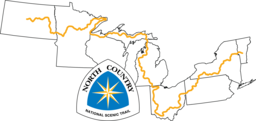
North Country National Scenic Trail
The North Country National Scenic Trail crosses the northern United States from Lake Sakakawea in North Dakota to Crown Point, New York, linking scenic, natural, historic and cultural areas across a great variety of northern landscapes.
- Length
- 4,600 mi7,403 km
- Time
- About 8 to 12 months estimate
- GPX
- GPX hereGPX and GeoJSON
- Climb
- 342,953 ft104,532 mcomputed
-

National Scenic Trail
Pacific Northwest National Scenic Trail PNT
The Pacific Northwest Trail runs east to west from Chief Mountain in Glacier National Park, Montana, to Cape Alava in Olympic National Park, Washington.
- Length
- 1,200 mi1,931 km
- Time
- About 2 months
- GPX
- GPX hereGPX and GeoJSON
- Climb
- 218,520 ft66,605 mcomputed
-

Great Divide Trail GDT
The Great Divide Trail follows the Continental Divide through Alberta and British Columbia, from Waterton Lakes National Park at the United States border to Kakwa Lake.
- Length
- 702 mi1,130 km
- Time
- About 8 weeks
- GPX
- GPX hereGPX and GeoJSON
- Climb
- 122,398 ft37,307 mcomputed
-

National Scenic Trail
Arizona National Scenic Trail AZT
The Arizona National Scenic Trail crosses Arizona from the Mexico border to the Utah border.
AZ United States
- Length
- 800 mi1,287 km
- Time
- 6 to 9 weeks
- GPX
- GPX hereGPX and GeoJSON
- Climb
- 104,081 ft31,724 mcomputed
-

Sentier international des Appalaches (International Appalachian Trail, Quebec and New Brunswick) IAT
The Sentier international des Appalaches listed here runs from Perth-Andover in New Brunswick to Forillon National Park in Quebec.
- Length
- 731 mi1,177 km
- Time
- About 6 to 8 weeks estimate
- GPX
- GPX hereGPX and GeoJSON
- Climb
- 96,306 ft29,354 mcomputed
-

Buckeye Trail
The Buckeye Trail is a continuous loop around the state of Ohio, with no beginning or end.
OH United States
- Length
- 1,398 mi2,250 km
- Time
- About 2 to 4 months estimate
- GPX
- GPX hereGPX and GeoJSON
- Climb
- 93,402 ft28,469 mcomputed
-

Mountains-to-Sea Trail MST
The Mountains-to-Sea Trail stretches across North Carolina from the Great Smoky Mountains to the Outer Banks, taking in mountain vistas, rolling Piedmont farms, hardwood and pine forests, coastal swamps, lighthouses, sand dunes and miles of seashore.
NC United States
- Length
- 1,174 mi1,890 km
- Time
- 3 to 4 months
- GPX
- GPX hereGPX and GeoJSON
- Climb
- 89,521 ft27,286 mcomputed
-

Finger Lakes Trail FLT
The Finger Lakes Trail crosses southern New York from the Pennsylvania border in Allegany State Park to the Long Path and Slide Mountain in the Catskills.
NY United States
- Length
- 580 mi933 km
- Time
- About 5 to 7 weeks estimate
- GPX
- GPX hereGPX and GeoJSON
- Climb
- 89,229 ft27,197 mcomputed
-
Colorado Trail CT
The Colorado Trail runs from Waterton Canyon near Denver to Durango, across high mountain country and several national forests and wilderness areas.
CO United States
- Length
- 486 mi782 km
- Time
- 4 to 6 weeks
- GPX
- GPX hereGPX and GeoJSON
- Climb
- 85,305 ft26,001 mcomputed
-

Long Trail (Vermont)
The Long Trail runs the length of Vermont along the Green Mountains, from the Massachusetts border to the Canadian border.
VT United States
- Length
- 272 mi438 km
- Time
- 3 to 4 weeks
- GPX
- GPX hereGPX and GeoJSON
- Climb
- 66,775 ft20,353 mcomputed
-

Benton MacKaye Trail BMT
The Benton MacKaye Trail starts on Springer Mountain in Georgia, shared with the Appalachian Trail, and runs north through Tennessee and North Carolina to Big Creek in the Great Smoky Mountains.
- Length
- 288 mi463 km
- Time
- 3 to 4 weeks
- GPX
- GPX hereGPX and GeoJSON
- Climb
- 62,362 ft19,008 mcomputed
-

Vancouver Island Trail VIT
The Vancouver Island Trail runs the length of Vancouver Island in British Columbia from Victoria in the south to Cape Scott on the northern tip.
BC Canada
- Length
- 497 mi800 km
- Time
- 4 to 9 weeks
- GPX
- GPX hereGPX and GeoJSON
- Climb
- 61,289 ft18,681 mcomputed
-

National Scenic Trail
Ice Age National Scenic Trail IAT
The Ice Age Trail is a thousand-mile footpath across Wisconsin that traces the landscape left by the last continental glacier, from Interstate State Park at St. Croix Falls to Potawatomi State Park at Sturgeon Bay.
WI United States
- Length
- 1,200 mi1,931 km
- Time
- About 2 to 3 months estimate
- GPX
- GPX hereGPX and GeoJSON
- Climb
- 54,350 ft16,566 mcomputed
-
Mid State Trail MST
The Mid State Trail stretches from near Flintstone, Maryland, through the center of Pennsylvania to the New York State line just north of Cowanesque Lake, crossing four regions from south to north.
PA United States
- Length
- 320 mi515 km
- Time
- About 3 to 4 weeks estimate
- GPX
- GPX hereGPX and GeoJSON
- Climb
- 49,403 ft15,058 mcomputed
-

Bruce Trail
The Bruce Trail runs along the Niagara Escarpment in Ontario, from Niagara to Tobermory.
ON Canada
- Length
- 553 mi890 km
- Time
- About 4 weeks
- GPX
- GPX hereGPX and GeoJSON
- Climb
- 49,373 ft15,049 mcomputed
-
Pinhoti Trail
The Pinhoti Trail is a Southern Appalachian long-distance trail through Alabama and Georgia.
- Length
- 336 mi540 km
- Time
- About 4 weeks
- GPX
- GPX hereGPX and GeoJSON
- Climb
- 45,246 ft13,791 mcomputed
-
Tuscarora Trail
The Tuscarora Trail is a long alternate to the Appalachian Trail through the Ridge and Valley Appalachians of Virginia, West Virginia, Maryland and Pennsylvania.
- Length
- 252 mi406 km
- Time
- About 2 to 3 weeks estimate
- GPX
- GPX hereGPX and GeoJSON
- Climb
- 36,371 ft11,086 mcomputed
-
Big SEKI Loop BSL
Route by Amy and James (Doing Miles), 2013
The Big SEKI Loop is a high Sierra Nevada loop in Sequoia and Kings Canyon National Parks that starts and ends at Roads End in Kings Canyon.
CA United States
- Length
- 155 mi249 km
- Time
- 7 to 12 days
- GPX
- GPX hereGPX and GeoJSON
- Climb
- 36,286 ft11,060 mcomputed
-

National Scenic Trail
New England National Scenic Trail NET
The New England Trail runs from Long Island Sound in Connecticut across long ridges to the Massachusetts-New Hampshire border, passing through 41 communities along the way.
- Length
- 235 mi378 km
- Time
- 2 to 4 weeks
- GPX
- GPX hereGPX and GeoJSON
- Climb
- 36,125 ft11,011 mcomputed
-
John Muir Trail JMT
The John Muir Trail is a world-famous trail stretching from Yosemite Valley to Mount Whitney, the highest point in the contiguous United States.
CA United States
- Length
- 211 mi340 km
- Time
- About 3 weeks
- GPX
- GPX hereGPX and GeoJSON
- Climb
- 35,650 ft10,866 mcomputed
-
Superior Hiking Trail SHT
The Superior Hiking Trail tours Lake Superior's North Shore in Minnesota from south of Duluth to near the Canadian border.
MN United States
- Length
- 310 mi499 km
- Time
- 2 to 4 weeks
- GPX
- GPX hereGPX and GeoJSON
- Climb
- 34,879 ft10,631 mcomputed
-

East Coast Trail (Newfoundland) ECT
The East Coast Trail is a network of wilderness coastal paths on the Avalon Peninsula of Newfoundland, running south to Cappahayden.
NL Canada
- Length
- 209 mi336 km
- Time
- About 2 weeks estimate
- GPX
- GPX hereGPX and GeoJSON
- Climb
- 34,386 ft10,481 mcomputed
-
Ouachita National Recreation Trail OT
The Ouachita National Recreation Trail stretches through the Ouachita Mountains of Arkansas and Oklahoma, from Talimena State Park through Queen Wilhelmina State Park to Pinnacle Mountain State Park near Little Rock.
- Length
- 223 mi359 km
- Time
- About 2 to 3 weeks estimate
- GPX
- GPX hereGPX and GeoJSON
- Climb
- 32,635 ft9,947 mcomputed
-

Cohos Trail
The Cohos Trail runs north through New Hampshire from southern Crawford Notch to the Canadian border at Pittsburg, through the White Mountains and the Great North Woods.
NH United States
- Length
- 168 mi270 km
- Time
- 9 to 14 days
- GPX
- GPX hereGPX and GeoJSON
- Climb
- 32,264 ft9,834 mcomputed
-

Oregon Coast Trail OCT
The Oregon Coast Trail follows the Oregon coastline, crossing sandy beaches, forest-shaded corridors, majestic headlands and 28 coastal towns.
OR United States
- Length
- 404 mi650 km
- Time
- About 3 to 5 weeks estimate
- GPX
- GPX hereGPX and GeoJSON
- Climb
- 31,250 ft9,525 mcomputed
-

Tahoe Rim Trail TRT
The Tahoe Rim Trail is a loop of about 165 miles around the ridgelines of the Lake Tahoe Basin.
- Length
- 165 mi266 km
- Time
- About 2 weeks
- GPX
- GPX hereGPX and GeoJSON
- Climb
- 27,247 ft8,305 mcomputed
-

Ozark Trail (Missouri) OT
The Ozark Trail winds through the Missouri Ozarks in sections that are meant one day to run from St. Louis to the Arkansas border.
MO United States
- Length
- 230 mi370 km
- Time
- About 2 to 3 weeks estimate
- GPX
- GPX hereGPX and GeoJSON
- Climb
- 25,512 ft7,776 mcomputed
-
Bartram Trail BT
The Bartram Trail is a footpath in the Blue Ridge of Georgia and North Carolina, running from Russell Bridge to Cheoah Bald.
- Length
- 112 mi180 km
- Time
- About 6 to 9 days estimate
- GPX
- GPX hereGPX and GeoJSON
- Climb
- 25,509 ft7,775 mcomputed
-

International Appalachian Trail, Newfoundland and Labrador IATNL
The International Appalachian Trail in Newfoundland is a thru-hiker route from Port aux Basques north along the island's west coast to Crow Head, at the tip of the Great Northern Peninsula.
NL Canada
- Length
- 466 mi750 km
- Time
- About 4 to 5 weeks estimate
- GPX
- GPX hereGPX and GeoJSON
- Climb
- 25,354 ft7,728 mcomputed
-
Sunshine Coast Trail SCT
The Sunshine Coast Trail stretches from Sarah Point in Desolation Sound to Saltery Bay on British Columbia's upper Sunshine Coast.
BC Canada
- Length
- 112 mi180 km
- Time
- About 6 to 9 days estimate
- GPX
- GPX hereGPX and GeoJSON
- Climb
- 24,928 ft7,598 mcomputed
-

Highlands Trail
The Highlands Trail runs across the New Jersey and New York Highlands, connecting the Delaware and Hudson rivers, with continuations into Pennsylvania and Connecticut.
- Length
- 180 mi290 km
- Time
- About 1 to 2 weeks estimate
- GPX
- GPX hereGPX and GeoJSON
- Climb
- 24,783 ft7,554 mcomputed
-
Wonderland Trail
The Wonderland Trail is a loop of about 93 miles that goes all the way around Mount Rainier in Washington.
WA United States
- Length
- 93 mi150 km
- Time
- 10 to 14 days
- GPX
- GPX hereGPX and GeoJSON
- Climb
- 24,606 ft7,500 mcomputed
-
Metacomet-Monadnock Trail M-M
The Metacomet-Monadnock Trail runs from the Connecticut line in Massachusetts north across the state to the summit of Mount Monadnock in New Hampshire.
- Length
- 115 mi185 km
- Time
- About 7 to 10 days estimate
- GPX
- GPX hereGPX and GeoJSON
- Climb
- 21,706 ft6,616 mcomputed
-
Hoosier Heritage Trail
The Hoosier Heritage Trail is a long-distance trail across Indiana, published by the Hoosier Heritage Trail Association.
IN United States
- Length
- 161 mi259 km
- Time
- About 9 to 13 days estimate
- GPX
- GPX hereGPX and GeoJSON
- Climb
- 19,728 ft6,013 mcomputed
-
Fremont National Recreation Trail
The Fremont National Recreation Trail runs north to south through the Fremont National Forest in south-central Oregon, from Yamsay Mountain to Vee Lake near the California border.
OR United States
- Length
- 134 mi216 km
- Time
- About 8 to 11 days estimate
- GPX
- GPX hereGPX and GeoJSON
- Climb
- 19,659 ft5,992 mcomputed
-
Mason-Dixon Trail M-DT
The Mason-Dixon Trail connects the Appalachian Trail with the Brandywine Trail, starting at Whiskey Springs in Cumberland County, Pennsylvania, following the Susquehanna River to Havre de Grace, Maryland, then running through Delaware and ending at Chadds Ford, Pennsylvania, on the Brandywine River.
- Length
- 193 mi311 km
- Time
- About 2 weeks estimate
- GPX
- GPX hereGPX and GeoJSON
- Climb
- 18,980 ft5,785 mcomputed
-
Centennial Trail
The Centennial Trail crosses the Black Hills of South Dakota, from Bear Butte State Park to Wind Cave National Park.
SD United States
- Length
- 111 mi179 km
- Time
- About 6 to 9 days estimate
- GPX
- GPX hereGPX and GeoJSON
- Climb
- 18,346 ft5,592 mcomputed
-
Donut Hole Trail DHT
The Donut Hole Trail is a backpacking trail in north-central Pennsylvania that runs from the village of Jericho to Farrandsville, near Lock Haven.
PA United States
- Length
- 94 mi152 km
- Time
- About 6 to 8 days estimate
- GPX
- GPX hereGPX and GeoJSON
- Climb
- 18,123 ft5,524 mcomputed
-
Canol Heritage Trail
The Canol Heritage Trail follows an abandoned Second World War pipeline route from Norman Wells in the Northwest Territories to the Yukon border, across the Mackenzie Mountains.
NT Canada
- Length
- 231 mi371 km
- Time
- 2 to 3 weeks
- GPX
- GPX hereGPX and GeoJSON
- Climb
- 17,835 ft5,436 mcomputed
-
Maricopa Trail
The Maricopa Trail is a loop around the Phoenix area that links the regional parks of Maricopa County.
AZ United States
- Length
- 315 mi507 km
- Time
- About 2 to 4 weeks estimate
- GPX
- GPX hereGPX and GeoJSON
- Climb
- 16,729 ft5,099 mcomputed
-
Uinta Highline Trail
The Uinta Highline Trail traverses the Uinta Range in Utah from east to west, mostly above 10,000 feet in the High Uintas Wilderness.
UT United States
- Length
- 104 mi167 km
- Time
- About 6 to 9 days estimate
- GPX
- GPX hereGPX and GeoJSON
- Climb
- 16,414 ft5,003 mcomputed
-
Horse-Shoe Trail HST
The Horse-Shoe Trail is a hiking and equestrian trail across southeastern Pennsylvania, starting in Valley Forge National Historical Park and ending at the Appalachian Trail.
PA United States
- Length
- 140 mi225 km
- Time
- About 8 to 12 days estimate
- GPX
- GPX hereGPX and GeoJSON
- Climb
- 16,286 ft4,964 mcomputed
-
Wyoming Range National Recreation Trail
The Wyoming Range National Recreation Trail runs along the crest of the Wyoming Range in western Wyoming, from the Bryan Flat Guard Station, south of the Hoback River, south to Snider Basin at the South Piney Creek trailhead.
WY United States
- Length
- 70 mi113 km
- Time
- About 4 to 6 days estimate
- GPX
- GPX hereGPX and GeoJSON
- Climb
- 15,627 ft4,763 mcomputed
-
North Umpqua Trail NUT
The North Umpqua Trail follows the North Umpqua River through southwest Oregon, from Bureau of Land Management land east through the Umpqua National Forest and into the Fremont-Winema National Forest.
OR United States
- Length
- 79 mi127 km
- Time
- About 5 to 7 days estimate
- GPX
- GPX hereGPX and GeoJSON
- Climb
- 15,617 ft4,760 mcomputed
-

Maah Daah Hey Trail
The Maah Daah Hey Trail is a non-motorized trail through the badlands of the Little Missouri National Grassland, from Burning Coal Vein Campground south of Medora to the CCC Campground south of Watford City.
ND United States
- Length
- 144 mi232 km
- Time
- About 8 to 12 days estimate
- GPX
- GPX hereGPX and GeoJSON
- Climb
- 15,305 ft4,665 mcomputed
-
Baker Trail
The Baker Trail is a hiking and backpacking trail north of Pittsburgh that runs through western Pennsylvania to Forest County.
PA United States
- Length
- 134 mi216 km
- Time
- About 8 to 11 days estimate
- GPX
- GPX hereGPX and GeoJSON
- Climb
- 15,302 ft4,664 mcomputed
-
River to River Trail R2R
The River to River Trail spans southern Illinois from the Ohio River to the Mississippi River, mostly in the Shawnee National Forest.
IL United States
- Length
- 160 mi257 km
- Time
- About 9 to 13 days estimate
- GPX
- GPX hereGPX and GeoJSON
- Climb
- 14,849 ft4,526 mcomputed
-

Northville-Placid Trail NPT
The Northville-Placid Trail is a continuous wilderness footpath through the Adirondacks, from Waterfront Park in the village of Northville to Averyville Road in Lake Placid.
NY United States
- Length
- 137 mi220 km
- Time
- 8 to 11 days
- GPX
- GPX hereGPX and GeoJSON
- Climb
- 14,432 ft4,399 mcomputed
-
Toiyabe Crest National Recreation Trail
The Toiyabe Crest Trail follows the crest of the Toiyabe Range in central Nevada, from the Kingston Trailhead in the north to the North/South Twin Trailhead in the south.
NV United States
- Length
- 63 mi101 km
- Time
- About 4 to 6 days estimate
- GPX
- GPX hereGPX and GeoJSON
- Climb
- 14,403 ft4,390 mcomputed
-
Lost Coast Trail
The Lost Coast Trail follows a remote stretch of the northern California coast, from Usal Beach in Sinkyone Wilderness State Park north to the mouth of the Mattole River in the King Range National Conservation Area.
CA United States
- Length
- 50 mi80 km
- Time
- About 3 to 4 days estimate
- GPX
- GPX hereGPX and GeoJSON
- Climb
- 13,753 ft4,192 mcomputed
-

Sunapee-Ragged-Kearsarge Greenway SRKG
The Sunapee Ragged Kearsarge Greenway is a circle of trails in central New Hampshire encircling the Lake Sunapee area.
NH United States
- Length
- 75 mi121 km
- Time
- About 5 to 7 days estimate
- GPX
- GPX hereGPX and GeoJSON
- Climb
- 13,648 ft4,160 mcomputed
-
Boundary Trail #1 (Mount St. Helens)
Boundary Trail #1 runs east in the Gifford Pinchot National Forest in Washington, from the Hummocks Trail near Johnston Ridge in the Mount St. Helens National Volcanic Monument to Council Lake.
WA United States
- Length
- 53 mi86 km
- Time
- About 3 to 5 days estimate
- GPX
- GPX hereGPX and GeoJSON
- Climb
- 13,553 ft4,131 mcomputed
-

Foothills Trail
The Foothills Trail is a long backpacking trail through the mountains of upstate South Carolina and western North Carolina.
- Length
- 76 mi122 km
- Time
- 5 to 10 days
- GPX
- GPX hereGPX and GeoJSON
- Climb
- 13,333 ft4,064 mcomputed
-
Backbone Trail BBT
The Backbone Trail crosses the Santa Monica Mountains near Los Angeles, from Will Rogers State Historic Park to Point Mugu State Park.
CA United States
- Length
- 67 mi108 km
- Time
- About 4 to 6 days estimate
- GPX
- GPX hereGPX and GeoJSON
- Climb
- 13,159 ft4,011 mcomputed
-
Standing Stone Trail SST
The Standing Stone Trail connects the Tuscarora Trail in the south to the Mid State Trail in the north through Pennsylvania's ridge and valley country.
PA United States
- Length
- 85 mi137 km
- Time
- About 5 to 7 days estimate
- GPX
- GPX hereGPX and GeoJSON
- Climb
- 13,143 ft4,006 mcomputed
-
Boundary Trail (Pasayten Wilderness)
The Boundary Trail crosses the Pasayten Wilderness in Washington from the Irongate Trailhead in the southeast, north and west near the Canadian border, to its junction with the Pacific Crest Trail.
WA United States
- Length
- 73 mi117 km
- Time
- About 4 to 6 days estimate
- GPX
- GPX hereGPX and GeoJSON
- Climb
- 12,999 ft3,962 mcomputed
-
Susquehannock Trail System STS
The Susquehannock Trail System is a blazed loop through Potter and Clinton counties in north-central Pennsylvania.
PA United States
- Length
- 84 mi135 km
- Time
- About 5 to 7 days estimate
- GPX
- GPX hereGPX and GeoJSON
- Climb
- 12,759 ft3,889 mcomputed
-
Stein Valley Traverse
The Stein Valley Traverse crosses Stein Valley Nlaka'pamux Heritage Park in British Columbia from its east boundary to its west boundary, following the Stein River and its lakes.
BC Canada
- Length
- 50 mi80 km
- Time
- About 4 to 7 days estimate
- GPX
- GPX hereGPX and GeoJSON
- Climb
- 12,507 ft3,812 mcomputed
-
Laurel Highlands Hiking Trail LHHT
The Laurel Highlands Hiking Trail stretches along Laurel Mountain from the Youghiogheny River at Ohiopyle State Park to the Conemaugh Gorge near Johnstown.
PA United States
- Length
- 70 mi113 km
- Time
- 8 days
- GPX
- GPX hereGPX and GeoJSON
- Climb
- 12,320 ft3,755 mcomputed
-
Tonto Trail
The Tonto Trail follows the Tonto Platform, a bench about 3,900 feet below the South Rim of the Grand Canyon, from Red Canyon in the east to Garnet Canyon in the west.
AZ United States
- Length
- 95 mi153 km
- Time
- About 6 to 8 days estimate
- GPX
- GPX hereGPX and GeoJSON
- Climb
- 12,303 ft3,750 mcomputed
-
Alpine Trail #7
The Alpine Trail #7 runs in the Swan Mountain Range of the Flathead National Forest in Montana, from the junction with Columbia Mountain Trail #51 to Inspiration Point.
MT United States
- Length
- 55 mi88 km
- Time
- About 3 to 5 days estimate
- GPX
- GPX hereGPX and GeoJSON
- Climb
- 12,011 ft3,661 mcomputed
-

National Scenic Trail
Florida National Scenic Trail FT
The Florida National Scenic Trail runs the length of Florida, from Big Cypress National Preserve in the south to Gulf Islands National Seashore on the Panhandle coast.
FL United States
- Length
- 1,130 mi1,818 km
- Time
- 2 to 3 months
- GPX
- GPX hereGPX and GeoJSON
- Climb
- 11,965 ft3,647 mcomputed
-
Massanutten Trail
The Massanutten Trail is a 71-mile circuit of the ridges around the inner valley of Massanutten Mountain in the Shenandoah Valley of Virginia.
VA United States
- Length
- 71 mi114 km
- Time
- About 4 to 6 days estimate
- GPX
- GPX hereGPX and GeoJSON
- Climb
- 11,831 ft3,606 mcomputed
-

Loyalsock Trail LT
The Loyalsock Trail is an end-to-end trail through the Loyalsock State Forest in northern Pennsylvania, from PA Route 87 north of Montoursville to Mead Road near Laporte, with the remainder on private land.
PA United States
- Length
- 59 mi95 km
- Time
- About 4 to 5 days estimate
- GPX
- GPX hereGPX and GeoJSON
- Climb
- 11,591 ft3,533 mcomputed
-
General George Crook National Recreation Trail
The General Crook Trail follows the line of a military supply road set up in 1871 by General George Crook, along the Mogollon Rim in central Arizona.
AZ United States
- Length
- 138 mi222 km
- Time
- About 8 to 12 days estimate
- GPX
- GPX hereGPX and GeoJSON
- Climb
- 11,467 ft3,495 mcomputed
-

The Island Walk IW
The Island Walk is a loop around Prince Edward Island through 32 sections, passing through the island's two cities, Charlottetown and Summerside, and many small communities.
PE Canada
- Length
- 435 mi700 km
- Time
- About 5 weeks
- GPX
- GPX hereGPX and GeoJSON
- Climb
- 11,220 ft3,420 mcomputed
-

Midstate Trail (Massachusetts) MST
The Midstate Trail is a scenic footpath in Worcester County, 45 miles west of Boston, running from the Rhode Island border across the gentle hills of central Massachusetts to the New Hampshire border, where it connects to the Wapack Trail.
MA United States
- Length
- 92 mi148 km
- Time
- About 5 to 8 days estimate
- GPX
- GPX hereGPX and GeoJSON
- Climb
- 10,535 ft3,211 mcomputed
-

Oak Ridges Trail
The Oak Ridges Trail is a walking route along the Oak Ridges Moraine, from the Bruce Trail at Glen Haffy Conservation Area east of Caledon through forested tracts, conservation areas and country road allowances to the Castleton and Warkworth area of Northumberland County.
ON Canada
- Length
- 168 mi270 km
- Time
- About 9 to 14 days estimate
- GPX
- GPX hereGPX and GeoJSON
- Climb
- 10,344 ft3,153 mcomputed
-
Shawangunk Ridge Trail SRT
The Shawangunk Ridge Trail starts at the Appalachian Trail in High Point State Park in New Jersey and runs north along the Shawangunk Ridge in New York to Mohonk Preserve.
- Length
- 71 mi114 km
- Time
- About 4 to 6 days estimate
- GPX
- GPX hereGPX and GeoJSON
- Climb
- 10,010 ft3,051 mcomputed
-
Solitude Loop Trail
The Solitude Loop Trail is a loop around Cloud Peak in the Cloud Peak Wilderness of Wyoming's Bighorn Mountains.
WY United States
- Length
- 55 mi89 km
- Time
- About 3 to 5 days estimate
- GPX
- GPX hereGPX and GeoJSON
- Climb
- 9,954 ft3,034 mcomputed
-
Quehanna Trail QT
The Quehanna Trail is a loop through state forests in north-central Pennsylvania, with much of it in the Quehanna Wild Area.
PA United States
- Length
- 74 mi119 km
- Time
- About 4 to 6 days estimate
- GPX
- GPX hereGPX and GeoJSON
- Climb
- 9,688 ft2,953 mcomputed
-
Timberline Trail (Mount Hood)
The Timberline Trail circumnavigates Mount Hood in Oregon at or near tree line, entering the Mount Hood Wilderness.
OR United States
- Length
- 40 mi64 km
- Time
- 3 to 4 days
- GPX
- GPX hereGPX and GeoJSON
- Climb
- 9,518 ft2,901 mcomputed
-
Monadnock-Sunapee Greenway MSG
The Monadnock-Sunapee Greenway is a hiking trail linking Grand Monadnock with Mount Sunapee, winding along the Monadnock Highlands that divide the Connecticut and Merrimack river drainages in southwestern New Hampshire.
NH United States
- Length
- 50 mi80 km
- Time
- 3 to 4 days
- GPX
- GPX hereGPX and GeoJSON
- Climb
- 9,012 ft2,747 mcomputed
-
Mattabesett Trail
The Mattabesett Trail is a blue-blazed trail in central Connecticut that runs in a large horseshoe from River Road in Middletown to the Berlin Turnpike in Berlin.
CT United States
- Length
- 65 mi105 km
- Time
- About 4 to 6 days estimate
- GPX
- GPX hereGPX and GeoJSON
- Climb
- 8,927 ft2,721 mcomputed
-
Bristol Hills Trail
The Bristol Hills Trail is a branch trail of the Finger Lakes Trail in New York.
NY United States
- Length
- 55 mi89 km
- Time
- About 3 to 5 days estimate
- GPX
- GPX hereGPX and GeoJSON
- Climb
- 8,720 ft2,658 mcomputed
-
Black Canyon National Recreation Trail
The Black Canyon Trail is a long singletrack trail through the Sonoran Desert north of Phoenix, Arizona, in the foothills of the Bradshaw Mountains.
AZ United States
- Length
- 80 mi129 km
- Time
- About 5 to 7 days estimate
- GPX
- GPX hereGPX and GeoJSON
- Climb
- 8,379 ft2,554 mcomputed
-

Corvallis-to-the-Sea Trail C2C
The Corvallis-to-the-Sea Trail links the Willamette Valley with the Pacific Ocean, from Corvallis to Ona Beach in Oregon.
OR United States
- Length
- 60 mi97 km
- Time
- 5 to 6 days
- GPX
- GPX hereGPX and GeoJSON
- Climb
- 8,274 ft2,522 mcomputed
-
Border Route Trail BRT
The Border Route Trail is a wilderness hiking trail along the Minnesota and Ontario border, inside the Boundary Waters Canoe Area Wilderness in northeast Minnesota.
MN United States
- Length
- 65 mi105 km
- Time
- About 4 to 6 days estimate
- GPX
- GPX hereGPX and GeoJSON
- Climb
- 8,271 ft2,521 mcomputed
-

Traversée de Charlevoix
La Traversée de Charlevoix is a marked wilderness thru-hike in the Charlevoix backcountry of Quebec, run with booked cabins or campsites each night.
QC Canada
- Length
- 65 mi105 km
- Time
- 6 to 7 days
- GPX
- GPX hereGPX and GeoJSON
- Climb
- 7,979 ft2,432 mcomputed
-
La Cloche Silhouette Trail
The La Cloche Silhouette Trail is a loop in Killarney Provincial Park, a wilderness landscape of the La Cloche Mountains' white quartzite ridges, the pink granite coast of Georgian Bay and more than fifty exceptionally clear sapphire lakes.
ON Canada
- Length
- 50 mi80 km
- Time
- 7 to 10 days
- GPX
- GPX hereGPX and GeoJSON
- Climb
- 6,821 ft2,079 mcomputed
-

Grand Valley Trail
The Grand Valley Trail is a footpath in southern Ontario from the village of Belwood to Port Maitland on Lake Erie.
ON Canada
- Length
- 149 mi240 km
- Time
- About 8 to 12 days estimate
- GPX
- GPX hereGPX and GeoJSON
- Climb
- 6,365 ft1,940 mcomputed
-
Conestoga Trail
The Conestoga Trail runs north and south through Lancaster County, Pennsylvania, in woods, along streams and on roads.
PA United States
- Length
- 64 mi103 km
- Time
- About 4 to 6 days estimate
- GPX
- GPX hereGPX and GeoJSON
- Climb
- 6,155 ft1,876 mcomputed
-
West Coast Trail WCT
The West Coast Trail runs 75 kilometres through Pacific Rim National Park Reserve in British Columbia, from Pachena Bay in the north to Gordon River in the south.
BC Canada
- Length
- 47 mi75 km
- Time
- 6 to 8 days
- GPX
- GPX hereGPX and GeoJSON
- Climb
- 6,109 ft1,862 mcomputed
-
Paumanok Path
The Paumanok Path is a regional trail across Long Island, New York, from Rocky Point in Brookhaven Town to Montauk Point on the Atlantic Ocean in East Hampton Town.
NY United States
- Length
- 125 mi201 km
- Time
- About 7 to 11 days estimate
- GPX
- GPX hereGPX and GeoJSON
- Climb
- 6,056 ft1,846 mcomputed
-
Middle Fork Trail
The Middle Fork Trail follows the Middle Fork of the Salmon River through the Frank Church-River of No Return Wilderness in Idaho, from Big Hole at the meeting of Bear Valley and Marsh Creeks to Camas Creek.
ID United States
- Length
- 82 mi132 km
- Time
- About 5 to 7 days estimate
- GPX
- GPX hereGPX and GeoJSON
- Climb
- 5,988 ft1,825 mcomputed
-

Prescott Circle Trail PCT
The Prescott Circle Trail is a loop of linked non-motorized trails around Prescott in central Arizona, passing through high desert chaparral and ponderosa pine forest.
AZ United States
- Length
- 56 mi90 km
- Time
- 3 to 5 days
- GPX
- GPX hereGPX and GeoJSON
- Climb
- 5,833 ft1,778 mcomputed
-
Shenipsit Trail
The Shenipsit Trail runs north in central Connecticut from the Cobalt area of East Hampton to West Stafford, just south of the Massachusetts border.
CT United States
- Length
- 50 mi80 km
- Time
- About 3 to 4 days estimate
- GPX
- GPX hereGPX and GeoJSON
- Climb
- 5,164 ft1,574 mcomputed
-
Pukaskwa Coastal Hiking Trail
The Coastal Hiking Trail follows the Lake Superior shore in Pukaskwa National Park, Ontario.
ON Canada
- Length
- 37 mi60 km
- Time
- About 2 to 3 days estimate
- GPX
- GPX hereGPX and GeoJSON
- Climb
- 4,744 ft1,446 mcomputed
-
North/South Trail (Land Between the Lakes)
The North/South Trail runs the length of Land Between the Lakes in Kentucky and Tennessee, from the North Welcome Station to the South Welcome Station.
- Length
- 59 mi95 km
- Time
- About 4 to 5 days estimate
- GPX
- GPX hereGPX and GeoJSON
- Climb
- 4,603 ft1,403 mcomputed
-
North-South Trail
The North-South Trail is a hiking trail that runs through the state of Rhode Island, crossing state parks and management areas on land of many owners.
RI United States
- Length
- 78 mi125 km
- Time
- About 5 to 7 days estimate
- GPX
- GPX hereGPX and GeoJSON
- Climb
- 4,364 ft1,330 mcomputed
-

Sentier Nepisiguit Mi'gmaq Trail SNMT
The Sentier Nepisiguit Mi'gmaq Trail is a single-track hiking trail in northern New Brunswick.
NB Canada
- Length
- 93 mi150 km
- Time
- 6 to 12 days
- GPX
- GPX hereGPX and GeoJSON
- Climb
- 3,930 ft1,198 mcomputed
-
Cranberry Lake 50 CL50
The Cranberry Lake 50 is a loop of about 50 miles around Cranberry Lake in the Adirondacks of New York.
NY United States
- Length
- 50 mi80 km
- Time
- 3 to 5 days
- GPX
- GPX hereGPX and GeoJSON
- Climb
- 3,773 ft1,150 mcomputed
-
Cross Vermont Trail CVT
The Cross Vermont Trail crosses Vermont from the Connecticut River to Lake Champlain.
VT United States
- Length
- 90 mi145 km
- Time
- About 5 to 8 days estimate
- GPX
- GPX hereGPX and GeoJSON
- Climb
- 3,737 ft1,139 mcomputed
-
Kekekabic Trail KEK
The Kekekabic Trail is a primitive trail across the heart of the Boundary Waters Canoe Area Wilderness in northern Minnesota, from Snowbank Lake near Ely to the Gunflint Trail.
MN United States
- Length
- 41 mi66 km
- Time
- About 3 to 4 days estimate
- GPX
- GPX hereGPX and GeoJSON
- Climb
- 3,543 ft1,080 mcomputed
-
Lone Star Hiking Trail LSHT
The Lone Star Hiking Trail is a footpath-only route meandering across the breadth of the Sam Houston National Forest in East Texas, from near Richards east to near Cleveland.
TX United States
- Length
- 96 mi155 km
- Time
- About 6 to 8 days estimate
- GPX
- GPX hereGPX and GeoJSON
- Climb
- 3,419 ft1,042 mcomputed
-

Thames Valley Trail
The Thames Valley Trail follows the Thames and North Thames rivers through southwestern Ontario, from the Elgin County line south of Delaware through London to St. Marys.
ON Canada
- Length
- 68 mi110 km
- Time
- About 4 to 6 days estimate
- GPX
- GPX hereGPX and GeoJSON
- Climb
- 2,713 ft827 mcomputed
-
Batona Trail
The Batona Trail is a long trail through the New Jersey Pinelands that links three state forests: Brendan T. Byrne, Wharton and Bass River.
NJ United States
- Length
- 50 mi80 km
- Time
- About 3 to 4 days estimate
- GPX
- GPX hereGPX and GeoJSON
- Climb
- 666 ft203 mcomputed
-
Ocean to Lake Hiking Trail OTLHT
The Ocean to Lake Hiking Trail runs west from Hobe Sound Beach on the Atlantic coast to Lake Okeechobee in southeast Florida.
FL United States
- Length
- 62 mi99 km
- Time
- About 4 to 5 days estimate
- GPX
- GPX hereGPX and GeoJSON
- Climb
- 79 ft24 mcomputed