 Long Hikes
A list
A month or more
Trails that take more than four weeks to walk whole. 52 trails, 23 with a GPX here. A source states the time for 21 of these. For the other 31 it is estimated from the length, at 12 to 19 miles a day, or 7 to 12 where much of it is cross-country.
The longest is Sea-to-Sea Route, 7,775 miles (12,513 km). The shortest is Ozark Highlands Trail, 325 miles (523 km). 7 loops and 26 routes by 21 authors.
The quickest to walk whole is International Appalachian Trail, Newfoundland and Labrador, about 4 to 5 weeks, and the slowest is Sea-to-Sea Route, about 14 to 21 months. Terrain is on file for 45 of them; the most common is forest (22), desert (19), alpine (16) and canyon (10). By designation: National Scenic Trails (8) and Clubs and associations (13). The highest point stated is 14,278 ft4,352 m, on Continental Divide Trail.
52 trails
- Official trail with a GPX here
- Route with a GPX here
- No GPX here: its page says where to get one
-

Bruce Trail
The Bruce Trail runs along the Niagara Escarpment in Ontario, from Niagara to Tobermory.
ON Canada
- Length
- 553 mi890 km
- Time
- About 4 weeks
- GPX
- GPX hereGPX and GeoJSON
- Climb
- 49,373 ft15,049 mcomputed
-
Pinhoti Trail
The Pinhoti Trail is a Southern Appalachian long-distance trail through Alabama and Georgia.
- Length
- 336 mi540 km
- Time
- About 4 weeks
- GPX
- GPX hereGPX and GeoJSON
- Climb
- 45,246 ft13,791 mcomputed
-

The Island Walk IW
The Island Walk is a loop around Prince Edward Island through 32 sections, passing through the island's two cities, Charlottetown and Summerside, and many small communities.
PE Canada
- Length
- 435 mi700 km
- Time
- About 5 weeks
- GPX
- GPX hereGPX and GeoJSON
- Climb
- 11,220 ft3,420 mcomputed
-
Southeastern Serpentine Trail SST
Route by Cam Honan, 2011
The Southeastern Serpentine Trail is a route of 583 miles through the southern Appalachians, from Table Rock State Park in South Carolina to Springer Mountain in Georgia.
- Length
- 583 mi938 km
- Time
- 4 to 5 weeks
- GPX
- Free from its author
-

International Appalachian Trail, Newfoundland and Labrador IATNL
The International Appalachian Trail in Newfoundland is a thru-hiker route from Port aux Basques north along the island's west coast to Crow Head, at the tip of the Great Northern Peninsula.
NL Canada
- Length
- 466 mi750 km
- Time
- About 4 to 5 weeks estimate
- GPX
- GPX hereGPX and GeoJSON
- Climb
- 25,354 ft7,728 mcomputed
-

Bayou State Trail
The Bayou State Trail crosses Louisiana from Bodcau Wildlife Management Area in the north to Morgan City in the south.
LA United States
- Length
- 480 mi772 km
- Time
- About 4 to 6 weeks estimate
- GPX
- See the official site
-
Colorado Trail CT
The Colorado Trail runs from Waterton Canyon near Denver to Durango, across high mountain country and several national forests and wilderness areas.
CO United States
- Length
- 486 mi782 km
- Time
- 4 to 6 weeks
- GPX
- GPX hereGPX and GeoJSON
- Climb
- 85,305 ft26,001 mcomputed
-

Ozark Highlands Trail OHT
The Ozark Highlands Trail runs across northern Arkansas from Lake Fort Smith toward the Missouri border north of Norfork Lake.
AR United States
- Length
- 325 mi523 km
- Time
- About 4 to 6 weeks estimate
- GPX
- Partial GPX hereGPX and GeoJSON
Track measures 229 mi369.3 km of 325 mi523 km published
-

Finger Lakes Trail FLT
The Finger Lakes Trail crosses southern New York from the Pennsylvania border in Allegany State Park to the Long Path and Slide Mountain in the Catskills.
NY United States
- Length
- 580 mi933 km
- Time
- About 5 to 7 weeks estimate
- GPX
- GPX hereGPX and GeoJSON
- Climb
- 89,229 ft27,197 mcomputed
-
Mojave-Sonoran Trail MST
Route by Eric Poulin, 2021
The Mojave-Sonoran Trail is a winter route of about 625 miles from near Valley of Fire State Park in southern Nevada to Palm Canyon in the Kofa Wilderness of Arizona.
- Length
- 625 mi1,006 km
- Time
- 5 to 7 weeks
- GPX
- Free from its author
-

Condor Trail CT
Route by Condor Trail Association
The Condor Trail is a long thru-hiking route through the Los Padres National Forest of coastal central California.
CA United States
- Length
- 400 mi644 km
- Time
- About 5 to 8 weeks estimate
- GPX
- Free from its author
-
Basin and Range Trail BRT
Route by Eric Poulin, 2020
The Basin and Range Trail is a route of about 1,090 miles through Nevada's Basin and Range country.
NV United States
- Length
- 1,090 mi1,754 km
- Time
- 6 to 8 weeks
- GPX
- Sold by its author
-

Great Divide Trail GDT
The Great Divide Trail follows the Continental Divide through Alberta and British Columbia, from Waterton Lakes National Park at the United States border to Kakwa Lake.
- Length
- 702 mi1,130 km
- Time
- About 8 weeks
- GPX
- GPX hereGPX and GeoJSON
- Climb
- 122,398 ft37,307 mcomputed
-

Sentier international des Appalaches (International Appalachian Trail, Quebec and New Brunswick) IAT
The Sentier international des Appalaches listed here runs from Perth-Andover in New Brunswick to Forillon National Park in Quebec.
- Length
- 731 mi1,177 km
- Time
- About 6 to 8 weeks estimate
- GPX
- GPX hereGPX and GeoJSON
- Climb
- 96,306 ft29,354 mcomputed
-

National Scenic Trail
Arizona National Scenic Trail AZT
The Arizona National Scenic Trail crosses Arizona from the Mexico border to the Utah border.
AZ United States
- Length
- 800 mi1,287 km
- Time
- 6 to 9 weeks
- GPX
- GPX hereGPX and GeoJSON
- Climb
- 104,081 ft31,724 mcomputed
-

Vancouver Island Trail VIT
The Vancouver Island Trail runs the length of Vancouver Island in British Columbia from Victoria in the south to Cape Scott on the northern tip.
BC Canada
- Length
- 497 mi800 km
- Time
- 4 to 9 weeks
- GPX
- GPX hereGPX and GeoJSON
- Climb
- 61,289 ft18,681 mcomputed
-
Desert Winter Thru-Hike Desert WTH
Route by Brett Tucker ("Blisterfree") and partner, simBLISSity Ultralight Designs, 2026
The Desert Winter Thru-Hike is a route of about 800 miles across the Sonoran, Colorado and Mojave deserts, from Saguaro National Park to Joshua Tree National Park.
- Length
- 800 mi1,287 km
- Time
- About 1 to 2 months estimate
- GPX
- Not published
-

National Scenic Trail
Pacific Northwest National Scenic Trail PNT
The Pacific Northwest Trail runs east to west from Chief Mountain in Glacier National Park, Montana, to Cape Alava in Olympic National Park, Washington.
- Length
- 1,200 mi1,931 km
- Time
- About 2 months
- GPX
- GPX hereGPX and GeoJSON
- Climb
- 218,520 ft66,605 mcomputed
-
Mogollon Rim Trail MRT
Route by Brett Tucker ("Blisterfree")
The Mogollon Rim Trail is a route across Arizona's Rim Country, from the Parsons Trailhead outside Cottonwood through Sedona's redrock country, the Highline Trail, the White Mountains and the Blue Range to the New Mexico border, where it joins the Grand Enchantment Trail near Alma.
- Length
- 500 mi805 km
- Time
- About 1 to 2 months estimate
- GPX
- Sold by its author
-
Northern New Mexico Loop
Route by Brett Tucker ("Blisterfree") and collaborators
The Northern New Mexico Loop starts and ends at Santa Fe Plaza, touring the Jemez Mountains, the Continental Divide and the Sangre de Cristo Mountains on a clockwise circuit of northern New Mexico.
NM United States
- Length
- 500 mi805 km
- Time
- About 1 to 2 months estimate
- GPX
- Sold by its author
-
Sky Islands Traverse SKIT
Route by Brett Tucker ("Blisterfree"), 2011
The Sky Islands Traverse makes a circuitous journey across ten forest-clad mountain ranges of southeast Arizona, separated by grassland and desert valleys.
AZ United States
- Length
- 520 mi837 km
- Time
- About 1 to 2 months estimate
- GPX
- Not published
-

Blue Mountains Trail BMT
Route by Greater Hells Canyon Council, 2021
The Blue Mountains Trail is a long hiking route through northeast Oregon, from Joseph to John Day.
OR United States
- Length
- 530 mi853 km
- Time
- About 1 to 2 months estimate
- GPX
- Free from its author
-
Idaho Centennial Trail ICT
The Idaho Centennial Trail is the state trail of Idaho, running from Murphy Hot Springs on the Nevada border north through mountains and high desert to the state's northern boundary.
ID United States
- Length
- 900 mi1,448 km
- Time
- About 2 months estimate
- GPX
- Partial GPX hereGPX and GeoJSON
Track measures 182 mi292.5 km of 900 mi1,448 km published
-
Deseret Hiking Route DHR
Route by Kevin "LarryBoy" DeVries, 2019
The Deseret Hiking Route runs about 1,000 miles through Utah, from the Arizona border to Alturas Lake Creek in Idaho.
- Length
- 1,000 mi1,609 km
- Time
- About 2 to 3 months estimate
- GPX
- Free from its author
-

National Scenic Trail
Florida National Scenic Trail FT
The Florida National Scenic Trail runs the length of Florida, from Big Cypress National Preserve in the south to Gulf Islands National Seashore on the Panhandle coast.
FL United States
- Length
- 1,130 mi1,818 km
- Time
- 2 to 3 months
- GPX
- GPX hereGPX and GeoJSON
- Climb
- 11,965 ft3,647 mcomputed
-
Across Utah Route
Route by Jamal Green
The Across Utah Route crosses southern Utah from the Nevada and Utah state line to the Utah and Colorado state line in approximately 700 miles.
UT United States
- Length
- 700 mi1,127 km
- Time
- About 2 to 3 months estimate
- GPX
- See the official site
-

California Coastal Trail CCT
The California Coastal Trail is a connected public trail system planned to run the length of the California coast.
CA United States
- Length
- 1,200 mi1,931 km
- Time
- About 2 to 3 months estimate
- GPX
- See the official site
-

National Scenic Trail
Ice Age National Scenic Trail IAT
The Ice Age Trail is a thousand-mile footpath across Wisconsin that traces the landscape left by the last continental glacier, from Interstate State Park at St. Croix Falls to Potawatomi State Park at Sturgeon Bay.
WI United States
- Length
- 1,200 mi1,931 km
- Time
- About 2 to 3 months estimate
- GPX
- GPX hereGPX and GeoJSON
- Climb
- 54,350 ft16,566 mcomputed
-

Oregon Desert Trail ODT
The Oregon Desert Trail is a route of about 750 miles across Oregon's high desert, from outside Bend in the west to Lake Owyhee State Park in the east.
OR United States
- Length
- 746 mi1,200 km
- Time
- About 2 to 3 months estimate
- GPX
- See the official site
-
Southwestern Horseshoe SWH
Route by Cam Honan, 2012
The Southwestern Horseshoe is a route of about 1,782 miles that joins the Hayduke Trail, the Arizona Trail and the Grand Enchantment Trail in a horseshoe through Utah, Arizona and New Mexico.
- Length
- 1,781 mi2,867 km
- Time
- About 3 months
- GPX
- Free from its author
-

Grand Enchantment Trail GET
Route by Brett Tucker, 2003
The Grand Enchantment Trail is a route of over 770 miles from the edge of Phoenix in Arizona to the edge of Albuquerque in New Mexico.
- Length
- 770 mi1,239 km
- Time
- About 2 to 3 months estimate
- GPX
- Sold by its author
-
Hayduke Trail
Route by Joe Mitchell and Mike Coronella, 2005
The Hayduke Trail is an extremely challenging backcountry route linking six national parks of the Colorado Plateau, from Arches to Zion across southern Utah and northern Arizona.
- Length
- 800 mi1,287 km
- Time
- About 2 to 4 months estimate
- GPX
- Sold by its author
-
Hot Springs Trail HST
Route by Aria Zoner, 2016
The Hot Springs Trail is a route from Santa Barbara, California, to the Canadian border in Idaho that links 100 wild and resort hot spring areas.
- Length
- 2,421 mi3,896 km
- Time
- About 4 months
- GPX
- Sold by its author
-

Buckeye Trail
The Buckeye Trail is a continuous loop around the state of Ohio, with no beginning or end.
OH United States
- Length
- 1,398 mi2,250 km
- Time
- About 2 to 4 months estimate
- GPX
- GPX hereGPX and GeoJSON
- Climb
- 93,402 ft28,469 mcomputed
-

Mountains-to-Sea Trail MST
The Mountains-to-Sea Trail stretches across North Carolina from the Great Smoky Mountains to the Outer Banks, taking in mountain vistas, rolling Piedmont farms, hardwood and pine forests, coastal swamps, lighthouses, sand dunes and miles of seashore.
NC United States
- Length
- 1,174 mi1,890 km
- Time
- 3 to 4 months
- GPX
- GPX hereGPX and GeoJSON
- Climb
- 89,521 ft27,286 mcomputed
-
Montana Trail 406
Route by Montana Trail 406 Association
Montana Trail 406 is a long route across Montana, from the Idaho border to Fort Union near the North Dakota line.
MT United States
- Length
- 1,823 mi2,934 km
- Time
- 3 to 4 months
- GPX
- Free from its author
-
Brooks Range Traverse
Route by Luc Mehl and Sarah Histand, 2016
The Brooks Range Traverse crosses northern Alaska from Kivalina to Kaktovik, in three parts walked in 2016, 2017 and 2019.
AK United States
- Length
- 1,000 mi1,609 km
- Time
- About 3 to 4 months estimate
- GPX
- Free from its author
-

Great Colorado Route GCR
Route by Donovan "Iceman" Rice, 2026
The Great Colorado Route is a 32-section route across Colorado that mixes a high route with a traditional thru-hike.
CO United States
- Length
- 2,000 mi3,219 km
- Time
- About 4 months
- GPX
- Free from its author
-

Great Eastern Trail GET
The Great Eastern Trail links existing trails into a long footpath through the Appalachian Mountains, from Alabama to the Finger Lakes Trail in New York.
- Length
- 1,800 mi2,897 km
- Time
- About 3 to 5 months estimate
- GPX
- Partial GPX hereGPX and GeoJSON
Track measures 1,459 mi2,348.2 km of 1,800 mi2,897 km published
-

Great Basin Trail GBT
Route by Ryan "Dirtmonger" Sylva, 2019
The Great Basin Trail is a route of nearly 1,200 miles that its author worked out as a loop around the heart of the Great Basin, wholly within Nevada.
NV United States
- Length
- 1,200 mi1,931 km
- Time
- About 3 to 5 months estimate
- GPX
- See the official site
-

Great Plains Trail GPT
Route by Steve Myers (Great Plains Trail Alliance)
The Great Plains Trail runs north to south through the shortgrass prairies of the Great Plains, from Grassland National Park on the Canada border to the summit of Guadalupe Peak in Texas.
- Length
- 2,200 mi3,540 km
- Time
- About 4 to 6 months estimate
- GPX
- Free from its author
-
Great Western Loop GWL
Route by Andrew Skurka and Ryan Jordan, 2006
The Great Western Loop links the Pacific Crest, Pacific Northwest, Continental Divide, Grand Enchantment and Arizona trails together with a trail-less stretch through the Sonoran and Mojave Deserts into one circuit of the American West.
- Length
- 6,875 mi11,064 km
- Time
- About 7 months
- GPX
- Not published
-

National Scenic Trail
Appalachian National Scenic Trail AT
The Appalachian Trail follows the Appalachian Mountains from Springer Mountain in Georgia to Katahdin in Maine.
- Length
- 2,198 mi3,537 km
- Time
- 5 to 7 months
- GPX
- GPX hereGPX and GeoJSON
- Climb
- 466,594 ft142,218 mcomputed
-

National Scenic Trail
Continental Divide National Scenic Trail CDT
The Continental Divide Trail runs along the spine of the Rocky Mountains from the Mexican border in New Mexico to the Canadian border in Montana, through Colorado, Wyoming and Idaho.
- Length
- 3,100 mi4,989 km
- Time
- 5 to 7 months
- GPX
- GPX hereGPX and GeoJSON
- Climb
- 456,427 ft139,119 mcomputed
-
Desert Trail DT
Route by Desert Trail Association, with the route scouted by Russel Pengely, D. W. "Old Creosote" Tomer and Steve Tabor, 1972
The Desert Trail is a route of about 1,586 miles from the Mexican border through the deserts of California, Nevada and Oregon, with a 637-mile northern extension to Canada.
- Length
- 1,586 mi2,552 km
- Time
- About 4 to 7 months estimate
- GPX
- See the official site
-

National Scenic Trail
Pacific Crest National Scenic Trail PCT
The Pacific Crest Trail runs from the Mexican border to the Canadian border along the mountain ranges of California, Oregon and Washington.
- Length
- 2,650 mi4,265 km
- Time
- About 5 to 7 months estimate
- GPX
- GPX hereGPX and GeoJSON
- Climb
- 443,012 ft135,030 mcomputed
-
Vagabond Loop VL
Route by Ryan "Dirtmonger" Sylva, 2013
The Vagabond Loop is Ryan "Dirtmonger" Sylva's circuit of the Four Corners country in the American Southwest.
- Length
- 3,500 mi5,632 km
- Time
- About 6 to 9 months estimate
- GPX
- Free from its author
-
Eastern Continental Trail ECT
Route by M. J. Eberhart (trail name Nimblewill Nomad)
The Eastern Continental Trail is a route of about 4,400 miles that M. J. Eberhart, who goes by Nimblewill Nomad, walked in 1998 from the Florida Keys to northern Quebec.
FL AL GA TN NC VA WV MD PA NJ NY CT MA VT NH ME QC NB United States and Canada
- Length
- 4,400 mi7,081 km
- Time
- About 10 months
- GPX
- Free from its author
-
Route In Between RIB
Route by Kevin "LarryBoy" DeVries, 2019
The Route In Between links the Arizona Trail, the author's Deseret Hiking Route through Utah, and the Idaho Centennial Trail for a Mexico to Canada walk.
- Length
- 2,699 mi4,344 km
- Time
- About 7 to 12 months estimate
- GPX
- Free from its author
-
National Scenic Trail
North Country National Scenic Trail
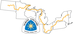
The North Country National Scenic Trail crosses the northern United States from Lake Sakakawea in North Dakota to Crown Point, New York, linking scenic, natural, historic and cultural areas across a great variety of northern landscapes.
- Length
- 4,600 mi7,403 km
- Time
- About 8 to 12 months estimate
- GPX
- GPX hereGPX and GeoJSON
- Climb
- 342,953 ft104,532 mcomputed
-
American Discovery Trail ADT
The American Discovery Trail is a coast-to-coast route of about 6,800 miles when both of its routes across the Midwest are counted, from Cape Henlopen State Park in Delaware to Limantour Beach at Point Reyes National Seashore in California.
DE MD DC WV OH KY IN IL IA MO KS NE CO UT NV CA United States
- Length
- 5,008 mi8,060 km
- Time
- About 9 to 13 months estimate
- GPX
- GPX hereGPX and GeoJSON
- Climb
- 378,484 ft115,362 mcomputed
-
Sea-to-Sea Route C2C
Route by Ron Strickland, 1996
The Sea-to-Sea Route is a network of existing long-distance hiking trails spanning almost continuously between the Atlantic and Pacific Oceans.
- Length
- 7,775 mi12,513 km
- Time
- About 14 to 21 months estimate
- GPX
- Free from its author
The map needs JavaScript. The list has every trail.
- Official trail
- Route
- No GPX here: start and end only
23 tracks, simplified for display. Select one for its name. 17 trails with no GPX here are shown as a dotted straight line between their start and end, or a ring where only one end is known. That is not the trail’s path. Each trail’s page names its source, credit and licence. Base map: OpenFreeMap, © OpenMapTiles, data © OpenStreetMap contributors.
Lists are picked out by rule from each trail’s facts, so they change as trails are added or corrected. A list is shown when it has at least 5 trails and no more than 75% of the 196.