A list
Prairie
Trails with prairie among their main terrain. 8 trails, 5 with a GPX here.
The map needs JavaScript. The list has every trail.
- Official trail
- Route
5 tracks, simplified for display. Select one for its name. Each trail’s page names its source, credit and licence. Base map: OpenFreeMap, © OpenMapTiles, data © OpenStreetMap contributors.
8 trails
- Official trail with a GPX here
- Route with a GPX here
- No GPX here: its page says where to get one
-
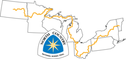
National Scenic Trail
North Country National Scenic Trail NCT
The North Country National Scenic Trail crosses the northern United States from Lake Sakakawea in North Dakota to Crown Point, New York, linking scenic, natural, historic and cultural areas across a great variety of northern landscapes.
- Length
- 7,403 km4,600 mi
- Time
- About 8 to 12 months estimate
- GPX
- GPX hereGPX and GeoJSON
- Climb
- 104,532 m342,953 ftcomputed
-
Great Western Trail GWT
The Great Western Trail is a multi-use corridor running north to south from Canada to Mexico through Arizona, Utah, Idaho, Wyoming and Montana.
- Length
- 4,800 km2,983 mi
- Time
- About 5 to 8 months estimate
- GPX
- See the official site
-
Great Plains Trail GPT
Route by Steve Myers (Great Plains Trail Alliance)
The Great Plains Trail runs north to south through the shortgrass prairies of the Great Plains, from Grassland National Park on the Canada border to the summit of Guadalupe Peak in Texas.
- Length
- 3,540 km2,200 mi
- Time
- About 4 to 6 months estimate
- GPX
- Free from its author
-

National Scenic Trail
Florida National Scenic Trail FNST
The Florida National Scenic Trail runs the length of Florida, from Big Cypress National Preserve in the south to Gulf Islands National Seashore on the Panhandle coast.
FL United States
- Length
- 2,414 km1,500 mi
- Time
- 2 to 3 months
- GPX
- GPX hereGPX and GeoJSON
- Climb
- 4,697 m15,410 ftcomputed
-

National Scenic Trail
Ice Age National Scenic Trail IAT
The Ice Age Trail is a thousand-mile footpath across Wisconsin that traces the landscape left by the last continental glacier, from Interstate State Park at St. Croix Falls to Potawatomi State Park at Sturgeon Bay.
WI United States
- Length
- 1,931 km1,200 mi
- Time
- About 2 to 3 months estimate
- GPX
- Partial GPX hereGPX and GeoJSON
Track measures 1,141.0 km of 1,931 km published
-
Waskahegan Trail WT
The Waskahegan Trail runs through the countryside around Edmonton, Alberta, and the neighbouring areas east and south of the city.
AB Canada
- Length
- 309 km192 mi
- Time
- About 2 weeks estimate
- GPX
- See the official site
-
River to River Trail R2R
The River to River Trail spans southern Illinois from the Ohio River to the Mississippi River, mostly in the Shawnee National Forest.
IL United States
- Length
- 257 km160 mi
- Time
- About 9 to 13 days estimate
- GPX
- GPX hereGPX and GeoJSON
- Climb
- 4,526 m14,849 ftcomputed
-
Maah Daah Hey Trail MDHT
The Maah Daah Hey Trail is a non-motorized trail through the badlands of the Little Missouri National Grassland, from Burning Coal Vein Campground south of Medora to the CCC Campground south of Watford City.
ND United States
- Length
- 232 km144 mi
- Time
- About 8 to 12 days estimate
- GPX
- GPX hereGPX and GeoJSON
- Climb
- 4,665 m15,305 ftcomputed
Lists are picked out by rule from each trail’s facts, so they change as trails are added or corrected. A list is shown when it has at least 4 trails and no more than 75% of the 138.