A list
The longest
Trails of 2,000 km (1,243 mi) or more. 19 trails, 6 with a GPX here.
The map needs JavaScript. The list has every trail.
- Official trail
- Route
6 tracks, simplified for display. Select one for its name. Each trail’s page names its source, credit and licence. Base map: OpenFreeMap, © OpenMapTiles, data © OpenStreetMap contributors.
19 trails
- Official trail with a GPX here
- Route with a GPX here
- No GPX here: its page says where to get one
-

The Great Trail (Trans Canada Trail) TCT
The Trans Canada Trail is the longest multi-use trail system in the world, a network that reaches every province and territory and connects all three of Canada's coastlines.
Across Canada Canada
- Length
- 28,000 km17,398 mi
- Time
- About 31 to 46 months estimate
- GPX
- See the official site
-
Sea-to-Sea Route C2C
Route by Ron Strickland, 1996
The Sea-to-Sea Route is a network of existing long-distance hiking trails spanning almost continuously between the Atlantic and Pacific Oceans.
- Length
- 12,513 km7,775 mi
- Time
- About 14 to 21 months estimate
- GPX
- Free from its author
-
Great Western Loop GWL
Route by Andrew Skurka and Ryan Jordan, 2006
The Great Western Loop links the Pacific Crest, Pacific Northwest, Continental Divide, Grand Enchantment and Arizona trails together with a trail-less stretch through the Sonoran and Mojave Deserts into one circuit of the American West.
- Length
- 11,064 km6,875 mi
- Time
- About 7 months
- GPX
- Not published
-
National Scenic Trail
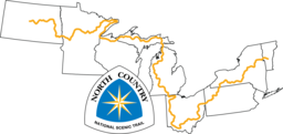
North Country National Scenic Trail NCT
The North Country National Scenic Trail crosses the northern United States from Lake Sakakawea in North Dakota to Crown Point, New York, linking scenic, natural, historic and cultural areas across a great variety of northern landscapes.
- Length
- 7,403 km4,600 mi
- Time
- About 8 to 12 months estimate
- GPX
- GPX hereGPX and GeoJSON
- Climb
- 104,532 m342,953 ftcomputed
-
Eastern Continental Trail ECT
Route by M. J. Eberhart (trail name Nimblewill Nomad)
The Eastern Continental Trail is a route of about 4,400 miles that M. J. Eberhart, who goes by Nimblewill Nomad, walked in 1998 from the Florida Keys to northern Quebec.
FL AL GA TN NC VA WV MD PA NJ NY CT MA VT NH ME QC NB United States and Canada
- Length
- 7,081 km4,400 mi
- Time
- About 10 months
- GPX
- Free from its author
-
Vagabond Loop VL
Route by Ryan "Dirtmonger" Sylva, 2013
The Vagabond Loop is Ryan "Dirtmonger" Sylva's circuit of the Four Corners country in the American Southwest.
- Length
- 5,632 km3,500 mi
- Time
- About 6 to 9 months estimate
- GPX
- Free from its author
-

National Scenic Trail
Continental Divide National Scenic Trail CDT
The Continental Divide Trail runs along the spine of the Rocky Mountains from the Mexican border in New Mexico to the Canadian border in Montana, through Colorado, Wyoming and Idaho.
- Length
- 4,989 km3,100 mi
- Time
- 5 to 7 months
- GPX
- GPX hereGPX and GeoJSON
- Climb
- 139,119 m456,427 ftcomputed
-
Great Western Trail GWT
The Great Western Trail is a multi-use corridor running north to south from Canada to Mexico through Arizona, Utah, Idaho, Wyoming and Montana.
- Length
- 4,800 km2,983 mi
- Time
- About 5 to 8 months estimate
- GPX
- See the official site
-
Route In Between RIB
Route by Kevin "LarryBoy" DeVries, 2019
The Route In Between links the Arizona Trail, the author's Deseret Hiking Route through Utah, and the Idaho Centennial Trail for a Mexico to Canada walk.
- Length
- 4,344 km2,699 mi
- Time
- About 7 to 12 months estimate
- GPX
- Free from its author
-

National Scenic Trail
Pacific Crest National Scenic Trail PCT
The Pacific Crest Trail runs from the Mexican border to the Canadian border along the mountain ranges of California, Oregon and Washington.
- Length
- 4,265 km2,650 mi
- Time
- About 5 to 7 months estimate
- GPX
- GPX hereGPX and GeoJSON
- Climb
- 135,030 m443,012 ftcomputed
-
Hot Springs Trail HST
Route by Aria Zoner, 2016
The Hot Springs Trail is a route from Santa Barbara, California, to the Canadian border in Idaho that links 100 wild and resort hot spring areas.
- Length
- 3,896 km2,421 mi
- Time
- About 4 months
- GPX
- Sold by its author
-
Iditarod National Historic Trail INHT
The Iditarod National Historic Trail is a winter trail system in Alaska made up of a 1,000-mile main trail between Seward and Nome and about 1,400 miles of side and connecting routes.
AK United States
- Length
- 3,701 km2,300 mi
- Time
- About 4 to 6 months estimate
- GPX
- See the official site
-
Great Plains Trail GPT
Route by Steve Myers (Great Plains Trail Alliance)
The Great Plains Trail runs north to south through the shortgrass prairies of the Great Plains, from Grassland National Park on the Canada border to the summit of Guadalupe Peak in Texas.
- Length
- 3,540 km2,200 mi
- Time
- About 4 to 6 months estimate
- GPX
- Free from its author
-

National Scenic Trail
Appalachian National Scenic Trail AT
The Appalachian Trail follows the Appalachian Mountains from Springer Mountain in Georgia to Katahdin in Maine.
- Length
- 3,537 km2,198 mi
- Time
- 5 to 7 months
- GPX
- GPX hereGPX and GeoJSON
- Climb
- 142,218 m466,594 ftcomputed
-
Great Colorado Route GCR
Route by Donovan "Iceman" Rice, 2026
The Great Colorado Route is a 32-section route across Colorado that mixes a high route with a traditional thru-hike.
CO United States
- Length
- 3,219 km2,000 mi
- Time
- About 4 months
- GPX
- Free from its author
-

Great Eastern Trail GET
The Great Eastern Trail links existing trails into a long footpath through the Appalachian Mountains, from Alabama to the Finger Lakes Trail in New York.
- Length
- 3,200 km1,988 mi
- Time
- About 4 to 5 months estimate
- GPX
- See the official site
-
Desert Trail DT
Route by Desert Trail Association, with the route scouted by Russel Pengely, D. W. "Old Creosote" Tomer and Steve Tabor, 1972
The Desert Trail is a route of about 1,586 miles from the Mexican border through the deserts of California, Nevada and Oregon, with a 637-mile northern extension to Canada.
- Length
- 2,552 km1,586 mi
- Time
- About 4 to 7 months estimate
- GPX
- See the official site
-

National Scenic Trail
Florida National Scenic Trail FNST
The Florida National Scenic Trail runs the length of Florida, from Big Cypress National Preserve in the south to Gulf Islands National Seashore on the Panhandle coast.
FL United States
- Length
- 2,414 km1,500 mi
- Time
- 2 to 3 months
- GPX
- GPX hereGPX and GeoJSON
- Climb
- 4,697 m15,410 ftcomputed
-

Buckeye Trail BT
The Buckeye Trail is a continuous loop around the state of Ohio, with no beginning or end.
OH United States
- Length
- 2,250 km1,398 mi
- Time
- About 2 to 4 months estimate
- GPX
- GPX hereGPX and GeoJSON
- Climb
- 28,469 m93,402 ftcomputed
Lists are picked out by rule from each trail’s facts, so they change as trails are added or corrected. A list is shown when it has at least 4 trails and no more than 75% of the 138.